Natural Bridges National Monument
26 April 2025 12:05 pmWe previously visited Natural Bridges National Monument on our family trip through this region back in 2009. On that trip we didn't spend a lot of time here, and only viewed the three natural bridges from the viewpoints, and didn't do any hiking. This was the only location from that trip that we would re-visit on this trip, and the plan was to hike down to each of the natural bridges for a closer look at them.
On our previous trip, we had learned the difference between an arch and a natural bridge. Natural Bridges are formed by running water, such as a creek or a river, while arches are formed by freezing ground water and wind erosion. The Natura Bridges National Monument includes the canyons of two streams that have formed three different natural bridges: Sipapu Bridge, Kachina Bridge, and Owachomo Bridge. In addition to the hikes to each of these bridges, we would also do the hike out to the overlook for the Horse Collar Ruin, which show that this area was once inhabited by Ancestral Puebloan peoples.
When we arrived, we discovered that the Visitor's Center was closed, which we hadn't expected. It was unclear if it was because the facility was still on their reduced, winter schedule, or if this was the result of budget constraints. Either way, the restrooms were open, and we were able to refill our water bottles before we headed around the one-way loop road to the overlook points and trail heads. Sipapu Bridge
The first stop on the loop was Sipapu Bridge, which has separate parking areas for the overlook and the trail head. From the overlook, this bridge is difficult to make out, with the coloring of the rocks forming a natural camouflage that makes it hard to see and even harder to photograph well.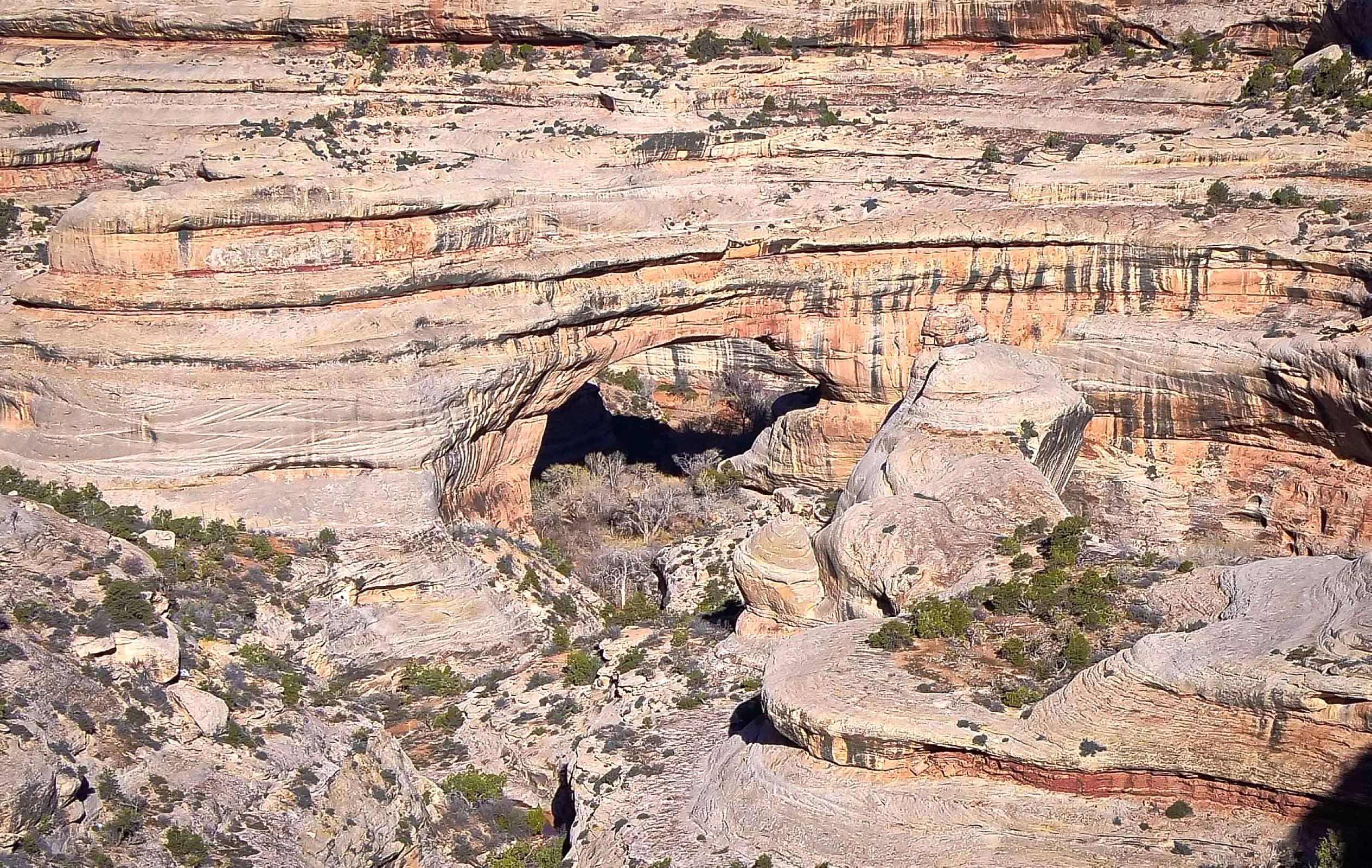


On our previous trip, we had learned the difference between an arch and a natural bridge. Natural Bridges are formed by running water, such as a creek or a river, while arches are formed by freezing ground water and wind erosion. The Natura Bridges National Monument includes the canyons of two streams that have formed three different natural bridges: Sipapu Bridge, Kachina Bridge, and Owachomo Bridge. In addition to the hikes to each of these bridges, we would also do the hike out to the overlook for the Horse Collar Ruin, which show that this area was once inhabited by Ancestral Puebloan peoples.
When we arrived, we discovered that the Visitor's Center was closed, which we hadn't expected. It was unclear if it was because the facility was still on their reduced, winter schedule, or if this was the result of budget constraints. Either way, the restrooms were open, and we were able to refill our water bottles before we headed around the one-way loop road to the overlook points and trail heads.
The first stop on the loop was Sipapu Bridge, which has separate parking areas for the overlook and the trail head. From the overlook, this bridge is difficult to make out, with the coloring of the rocks forming a natural camouflage that makes it hard to see and even harder to photograph well.
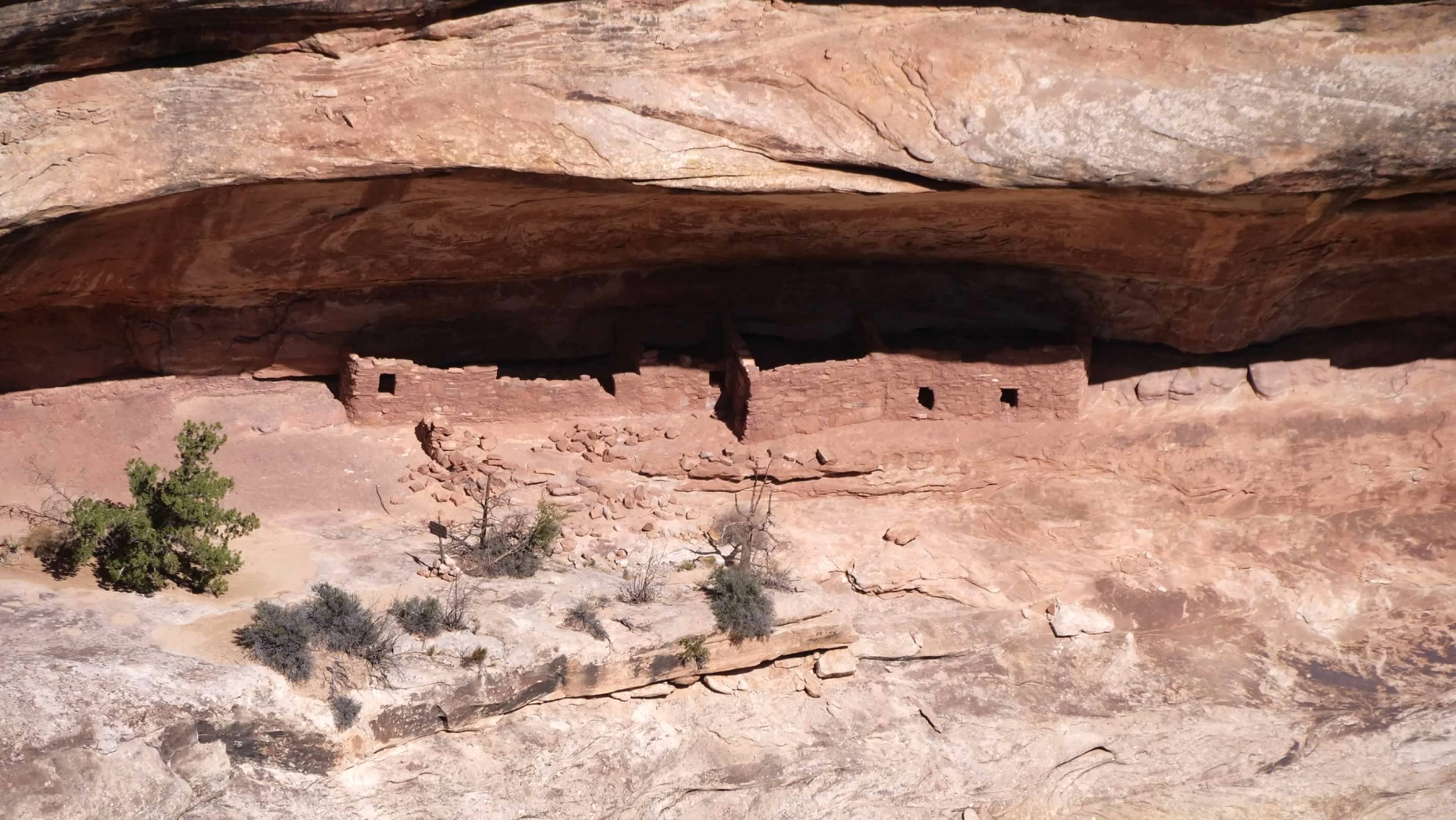
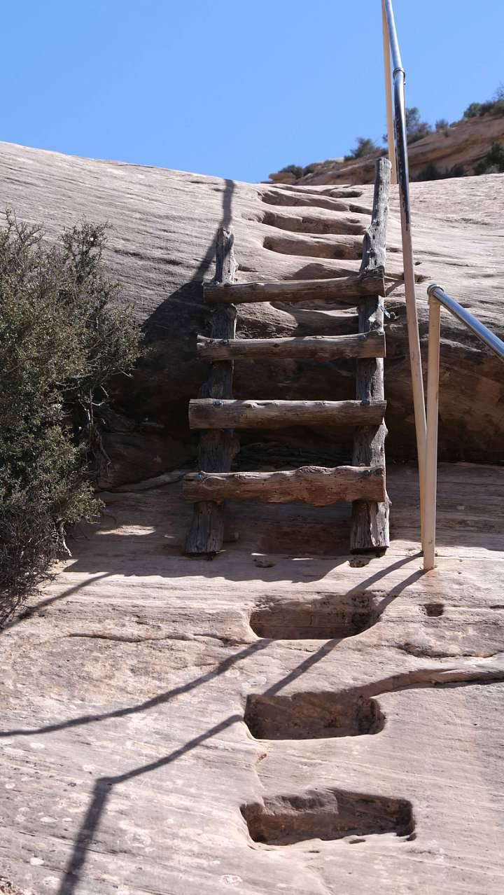
The hike down to Sipapu Bridge starts from the trail head parking lot, a bit further along the loop road after the overlook. The trail approaches the bridge from the other side, relative to the overlook, so as we hiked down, we had views of the other side of the bridge. The upper part of this trail was in the shadows of the cliff, and there was a short stretch of about 50 feet or so where the trail was covered with packed snow and was pretty slippery. The other challenge on this hike was the ladders, which scaled some of the steeper cliffs down into the canyon. About halfway down, we found some Ancestral Puebloan ruins tucked under a rock overhang, with a stunning view of the Sipapu Bridge.
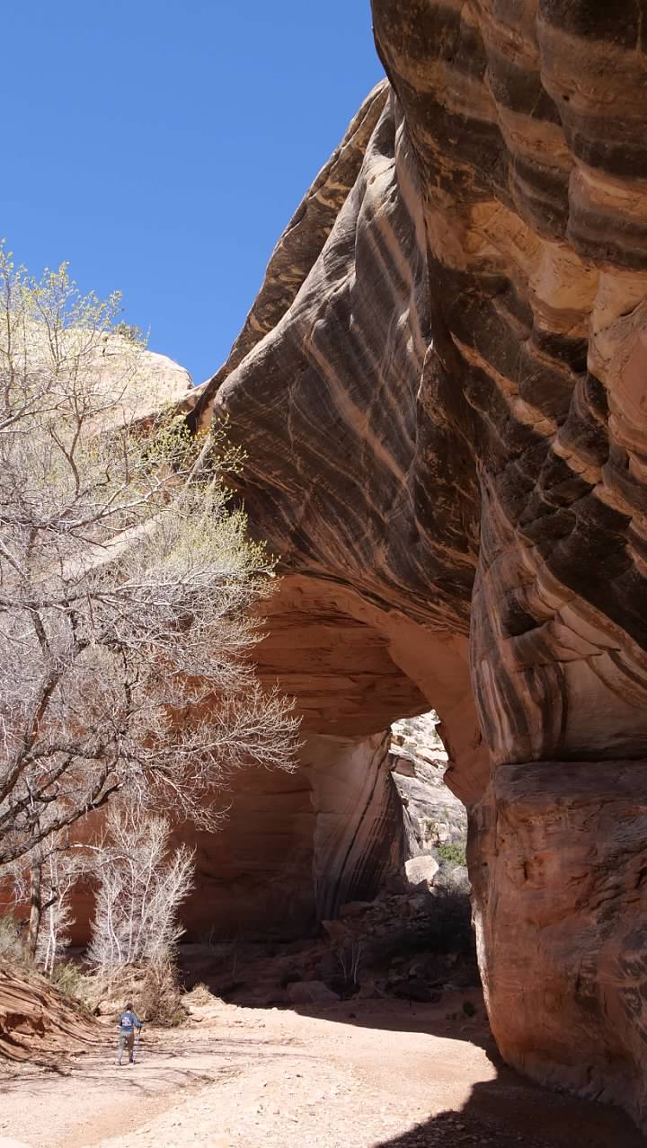
When we finally reached the canyon floor, we found ourselves almost directly under the bridge. Based on the position of the sun, I decided that the best place to try to get photos of the bridge was on the other side, so we walked under the bridge and along the stream bed for a bit until we got a good view back towards the bridge.
We then began to retrace our steps back up the trail to our car. The round trip distance for this hike was about 1.4 miles, with a total vertical drop of about 436 feet from the parking area to the canyon floor.
Horse Collar Ruin
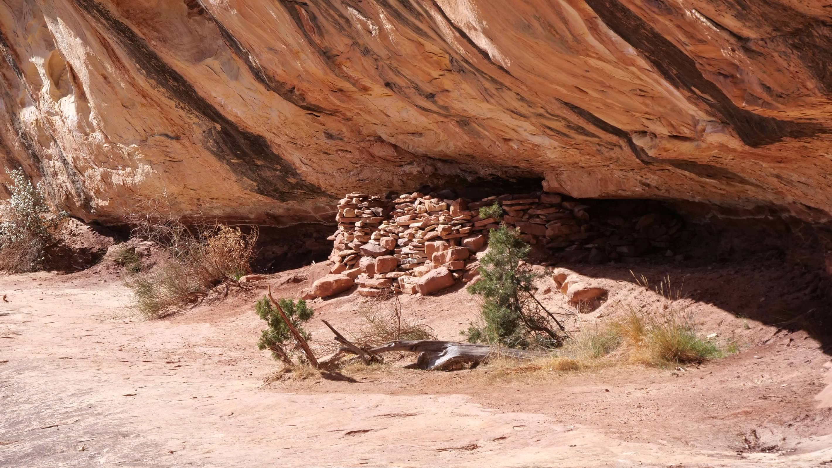
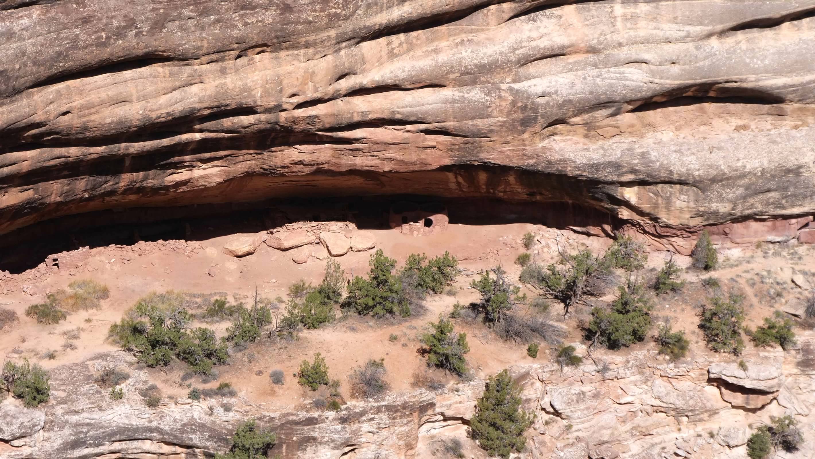
Our next hike was the relatively easy hike to the overlook for the Horse Collar Ruin. Because of the way we visited on our first visit, I don't think we gained any appreciation of this park as an Ancestral Puebloan site. None of the ruins are visible from the easily accessible overlooks, and I don't remember reading about them at the time. However, because we were hiking this time, we got to see some of the ruins, both up close, and from a distance. And while the natural bridges might be the star attractions here, the protection of these ruins is the real reason the area was originally designated as a National Monument.
The Horse Collar Ruin is located on the far side of the canyon, nestled under the overhanging rock ledge. The hike to the overlook to see them was an easy 0.6 mile round trip with very little vertical change. The overlook included signage that discussed what is known about the people who used to live here (which is apparently very little) and about the remaining mysteries surrounding their presence and disappearance.
Horse Collar Ruin
Our next hike was the relatively easy hike to the overlook for the Horse Collar Ruin. Because of the way we visited on our first visit, I don't think we gained any appreciation of this park as an Ancestral Puebloan site. None of the ruins are visible from the easily accessible overlooks, and I don't remember reading about them at the time. However, because we were hiking this time, we got to see some of the ruins, both up close, and from a distance. And while the natural bridges might be the star attractions here, the protection of these ruins is the real reason the area was originally designated as a National Monument.
The Horse Collar Ruin is located on the far side of the canyon, nestled under the overhanging rock ledge. The hike to the overlook to see them was an easy 0.6 mile round trip with very little vertical change. The overlook included signage that discussed what is known about the people who used to live here (which is apparently very little) and about the remaining mysteries surrounding their presence and disappearance.
Kachina Bridge
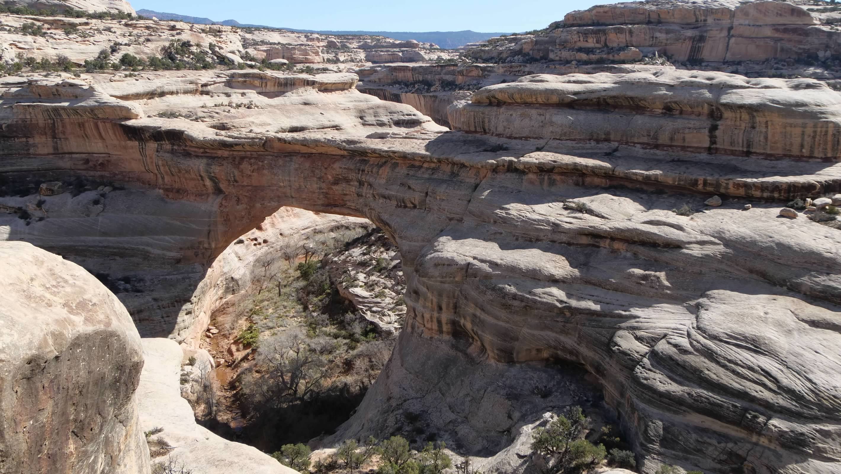
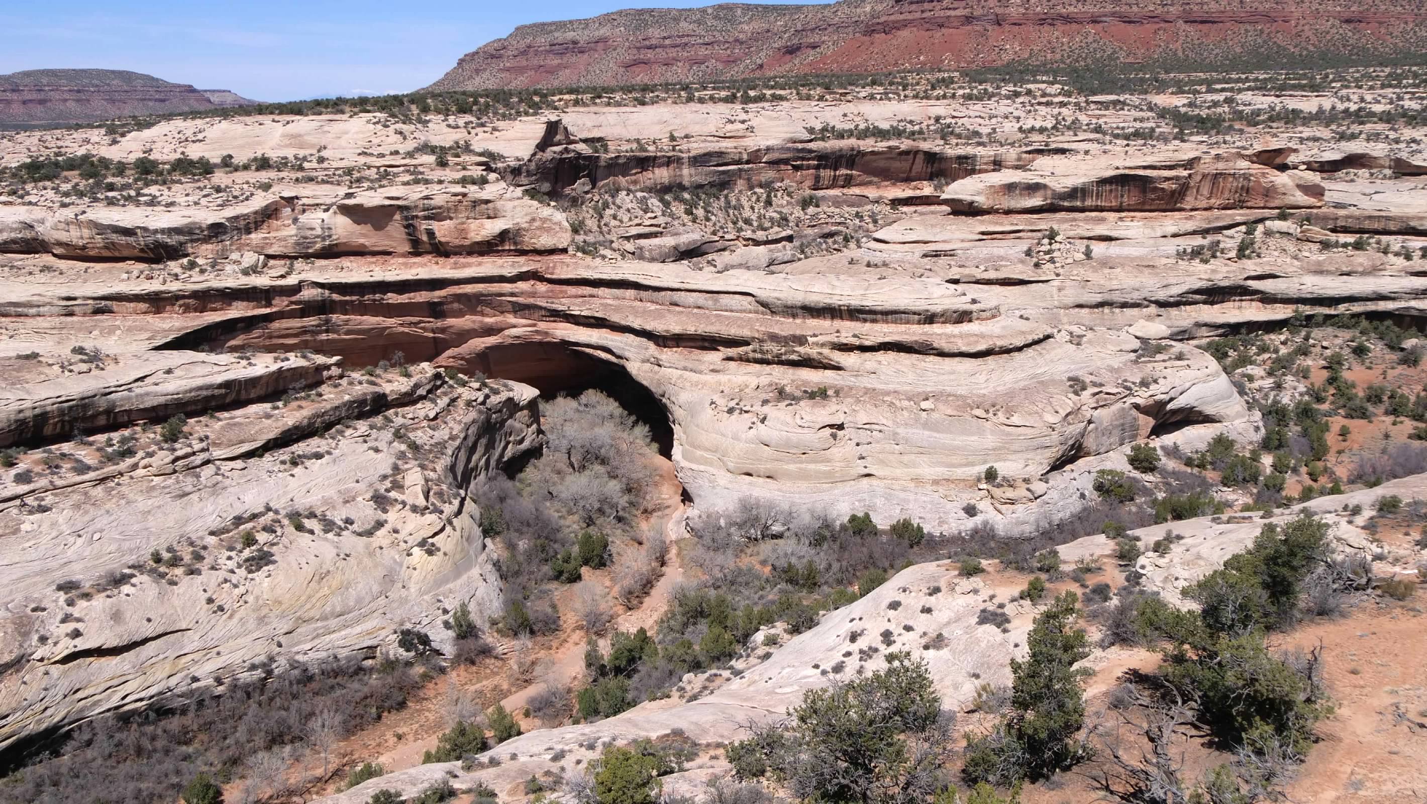
The overlook and trail head for Kachina Bridge share a single parking area. The walkway out to the overlook is paved, and provides a view down to the bridge at the junction of the White and Armstrong Canyons. This overlook also allows visitors to see how the bridges are formed, with the White Canyon forming a sharp bend here before the junction with the Armstrong Canyon. The stone that forms the bridge was part of the canyon wall in the middle of that bend until the water eroded its way through the wall to create the bridge.
The overlook and trail head for Kachina Bridge share a single parking area. The walkway out to the overlook is paved, and provides a view down to the bridge at the junction of the White and Armstrong Canyons. This overlook also allows visitors to see how the bridges are formed, with the White Canyon forming a sharp bend here before the junction with the Armstrong Canyon. The stone that forms the bridge was part of the canyon wall in the middle of that bend until the water eroded its way through the wall to create the bridge.
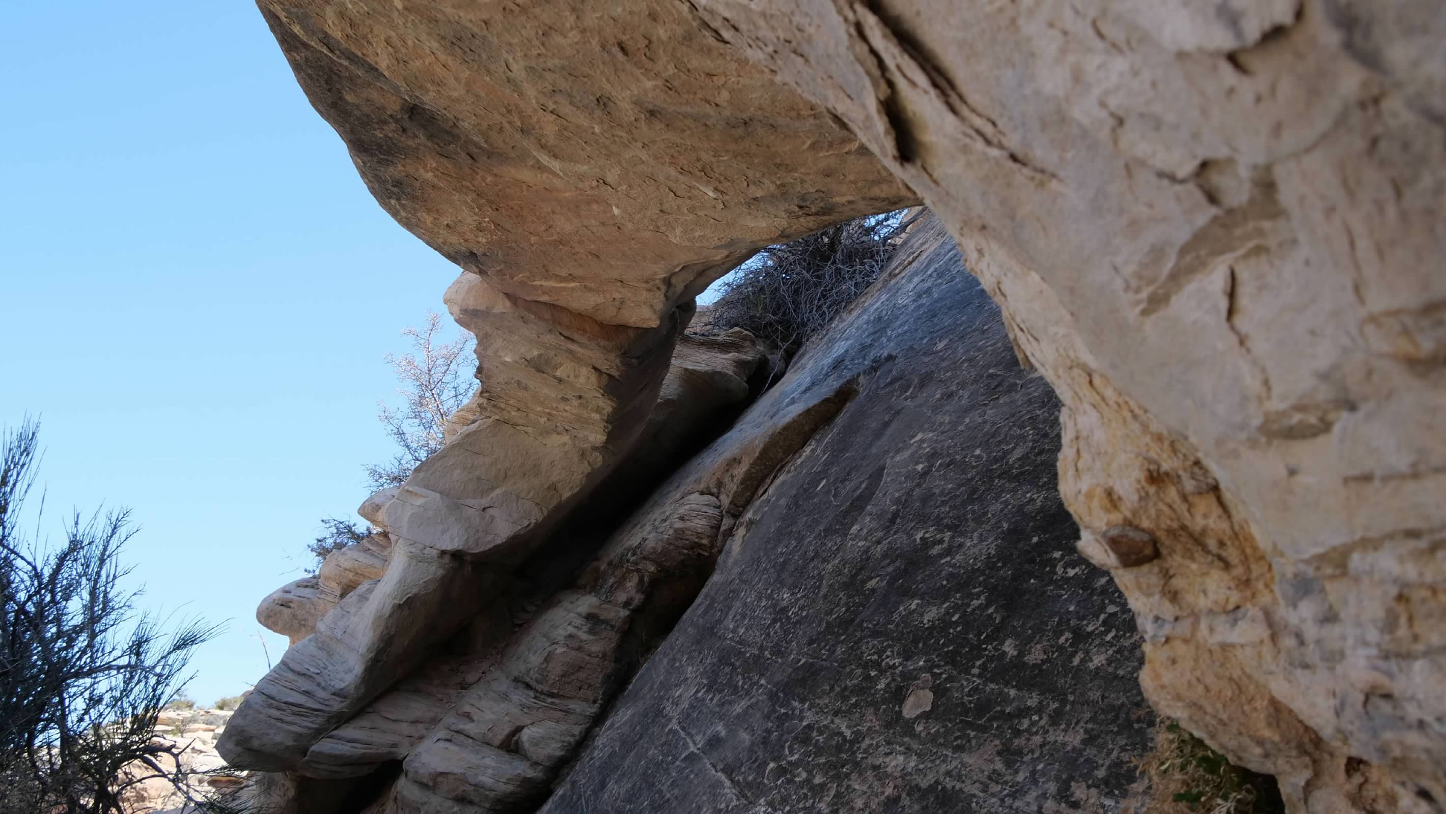
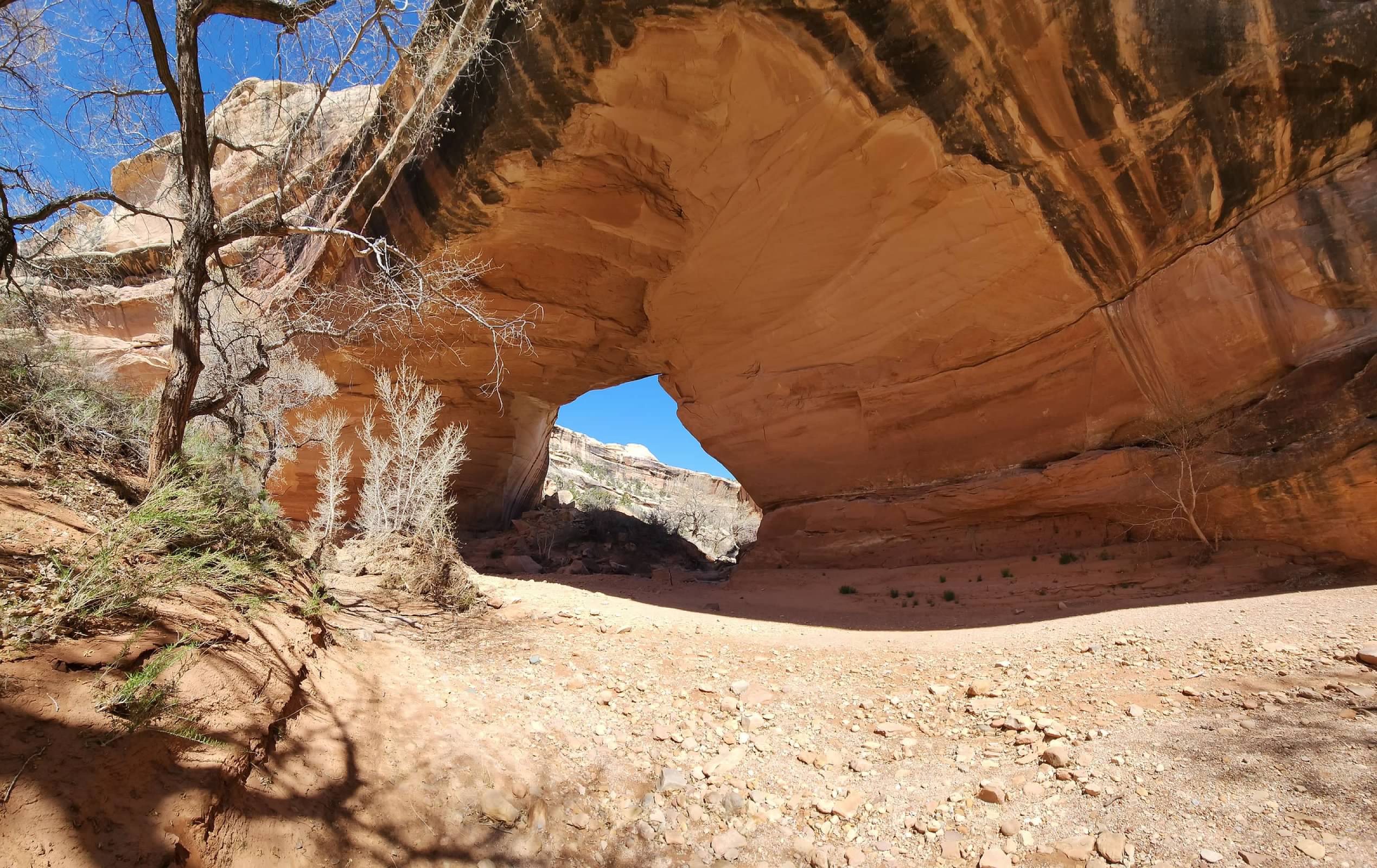
The trail down to the bridge branches off the paved path about halfway out to the overlook, and loops below the overlook before descending into the canyon. It begins with a series of switchbacks down the steeper part of the canyon wall, before emerging on the slip rock lower down. Part way down, we discovered a small arch forming on the canyon wall, right next to the hiking trail. We also had to navigate some ladders as part of our descent to the canyon floor.
At the bottom of the canyon, we had to walk along the dry streambed in Armstrong Canyon the rest of the way to the bridge. There was a large cluster of trees and brush growing where the streams from the two canyons merge, right next to the bridge, which made it difficult to get a good photo of the entire bridge from the canyon floor. However, after some experimenting, I was able to get a decent shot from a sharp angle along the canyon wall, looking at the bridge. I was also able to get a good wide angle shot of the bridge using my phone.
After taking in the views from the bridge, it was time to make our way back up and out of the canyon. The roundtrip hike was about 1.4 miles, with a total vertical drop of 462 feet from the parking area to the canyon floor.
Owachomo Bridge
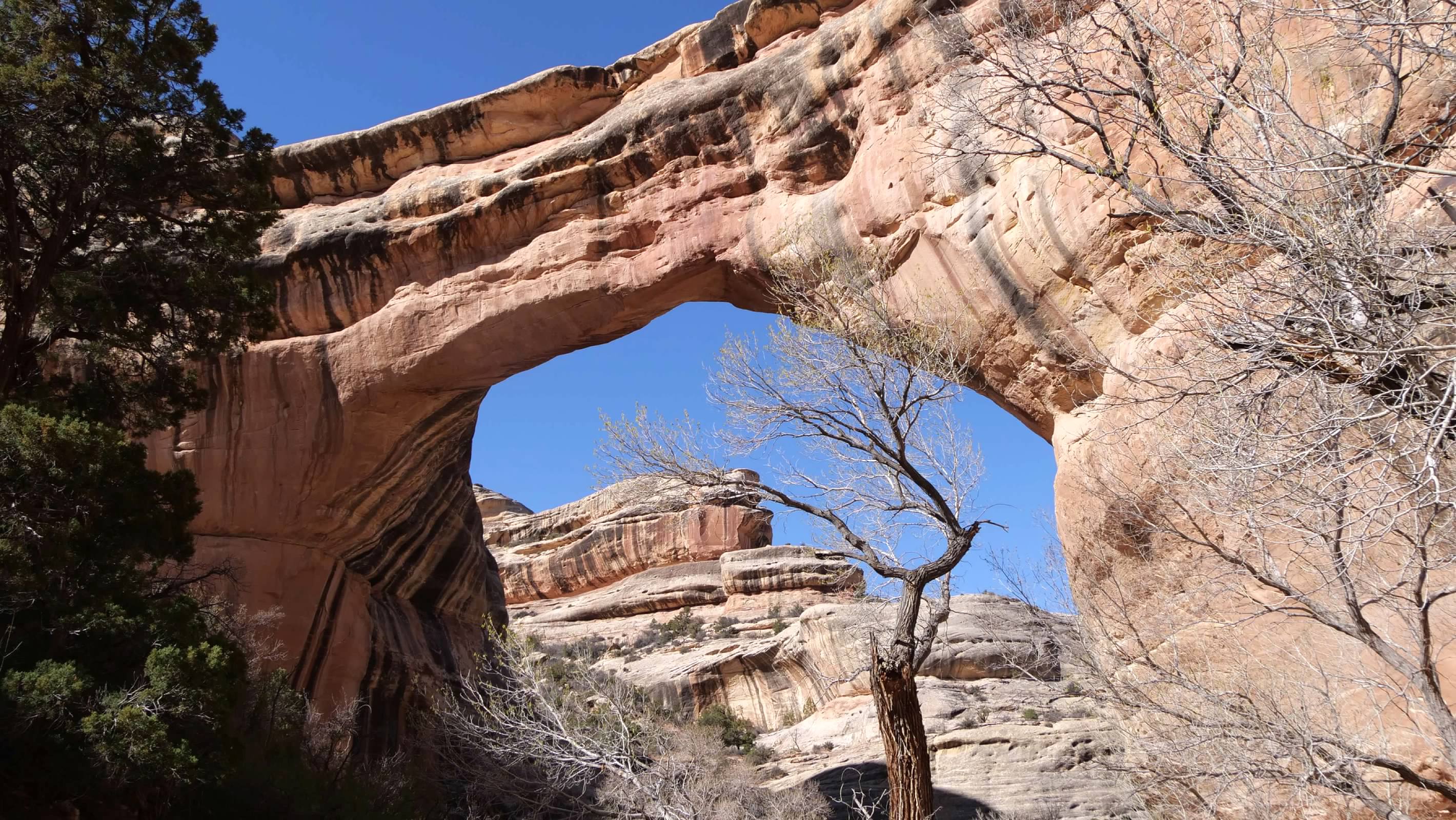
The final bridge was the easiest of the three to hike to. Again, the overlook and the trail head started from the same place, and we began by checking out the view of the bridge from the overlook.
Owachomo Bridge
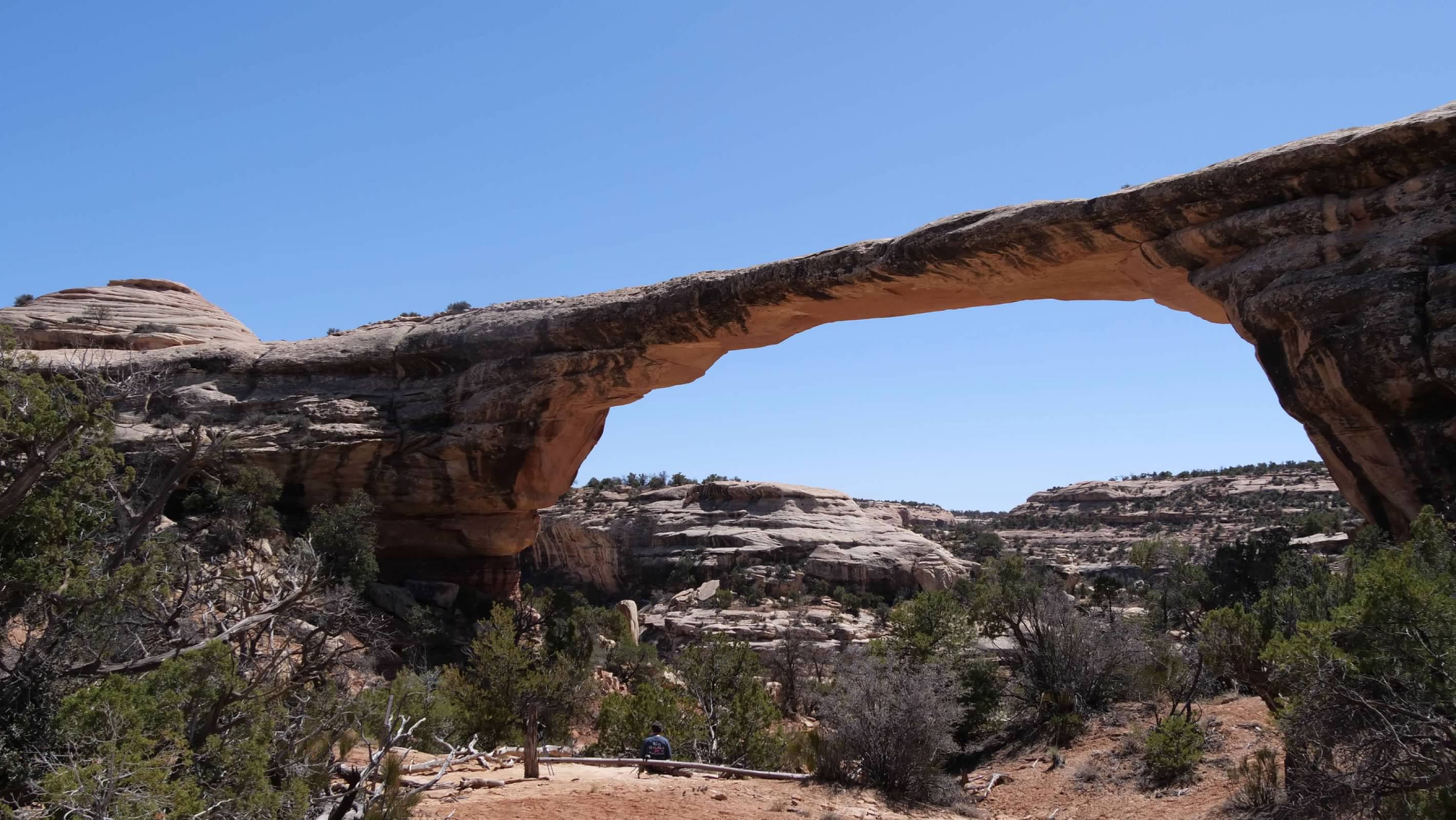
The final bridge was the easiest of the three to hike to. Again, the overlook and the trail head started from the same place, and we began by checking out the view of the bridge from the overlook.
Then we began our descent down the trail to the bridge. The trail here wasn't as long, nor as steep as at the earlier bridges, making this more of a stroll than a hike. The bridge is not actually at the bottom of the canyon, since the stream has since moved, leaving the bridge standing alongside the canyon. We walked under the bridge and took some photos looking back at it. We also spotted some more ruins on the cliff across the canyon, and unsuccessfully looked for some petroglyphs we were told were in the area. Then we returned back up the trail to the car. The total roundtrip distance for this hike was just 1/2 mile, with a vertical drop of just 188 feet from the parking area to the base of the bridge.
Having finished our hikes and our visit, we made one final stop at the visitor's center to top off our water bottles before we began our drive off to our next accommodations for the night.