Pinkham Notch
12 October 2024 03:36 pmBased on our experiences the previous day, we abandoned any thought of trying to hike up Mt. Washington as entirely unrealistic. While we might have been able to make the ascent, all the information we could find suggested that we not attempt it unless we were confident we could do the round trip. While it is possible to descend either on the cog railway or by shuttle down the auto highway, both of which reach the summit, both of these options prioritize round trip riders, and the operations of both are subject to the weather, so that there is no guarantee that a seat would be available. And while we could use either for the ascent, I was certain that my knees were not up for the hike down the mountain.
With that decision made, we opted for a series of shorter hikes in the Pinkham Notch on the east side of Mount Washington. This pass is the location of the Pinkham Notch Visitor Center, operated by the Appalachian Mountain Club, and located on the Appalachian Trail. I picked two shorter hikes to waterfalls. The trailhead parking lot for the third waterfall I hoped to visit was closed, so we decided to see if we could hike there from the Visitor Center, using a section of the Appalachian Trail to get there. However, we would have to cross the Ellis River near the trailhead to the falls, and it wasn't clear from my research what that crossing would entail, so we were prepared to turn around at that point, if necessary. We would finish our day with a visit to Jackson, New Hampshire, which had a covered bridge and a set of waterfalls in town.
 Our first stop took us to the Wildcat Mountain ski area for a short hike to Thompson Falls. We parked in the deserted ski area parking lot and walked to the base of the ski area. Our hike began along a self-guided nature trail at the base, before branching off into the forest and up to the falls. The signs along the nature trail described the local ecology and some of the history of the area, which was interesting. Much of this portion of the trail was originally used as a logging path to haul logs from the extensive timber industry that once dominated this region. The very existence of the White Mountain National Forest is a testament to the extent to which the trees of these mountains were harvested, ultimately leading to calls for conservation and the better resource management provided by the National Forest Service. The hike to the falls and back was not particularly taxing, and after we finished, we drove to the Pinkham Notch Visitor Center, where we would park for much of the day.
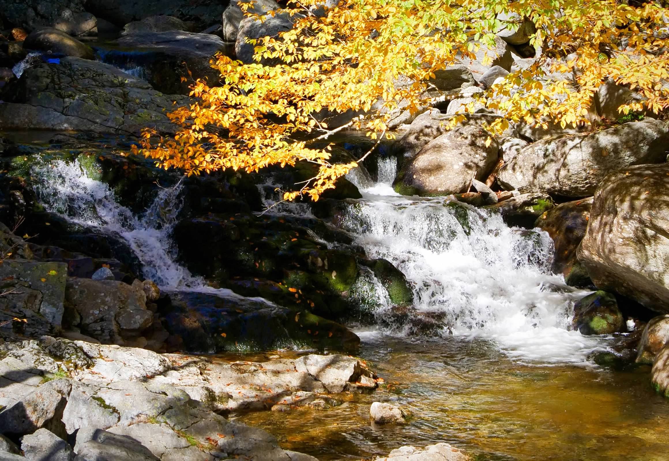 Our first hike from here was another short hike on a trail that ultimately would have taken us to the summit of Mt. Washington, had we continued, but our goal was the Crystal Cascade on the Ellis River, not very far above the visitor center. This waterfall included two smallish cascades, with the trail crossing the river on a footbridge between them. There was an extended family there taking family portraits on the rocks between the falls, so it took some creativity to get good shots without disturbing them.
After returning to the visitor center, we crossed the highway and started our hike to the Glen Ellis Falls. Our route began with a boardwalk through some wet lands behind what appeared to be very old beaver dams. We didn't see any evidence of any recent beaver activity, so it looks like these dams were long ago abandoned by the beaver. The trail (which served as a portion of the Appalachian Trail), turned south and ran parallel to the highway and worked its way around a quiet pond. As we worked our way around the pond, we came across a few sections of the trail that crossed some fields of giant boulders, requiring a little bit of rock scrambling to traverse. Eventually, we reached a trail junction where we could turn back towards the highway and the Glen Ellis Falls trailhead. But first, we had to traverse the Ellis River. At the Crystal Cascade, the river was still a relatively small stream, but by this point, it had grown significantly. But there were boulders scattered across the river, and it looked like they were close enough together for us to be able to cross the river by stepping from rock to rock. Luckily, the rocks were (mostly) dry and not very slippery, and we both were able to work our way across the river without getting wet.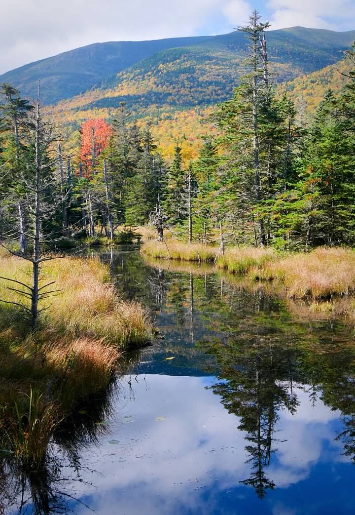
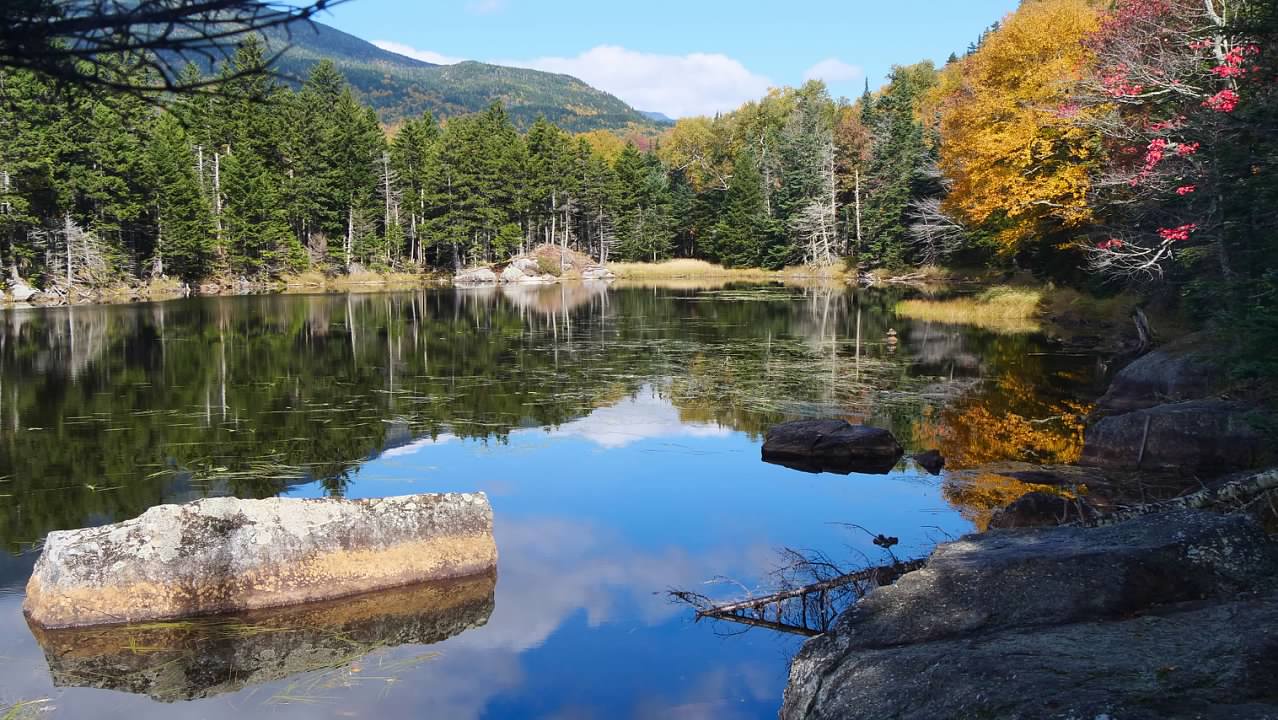
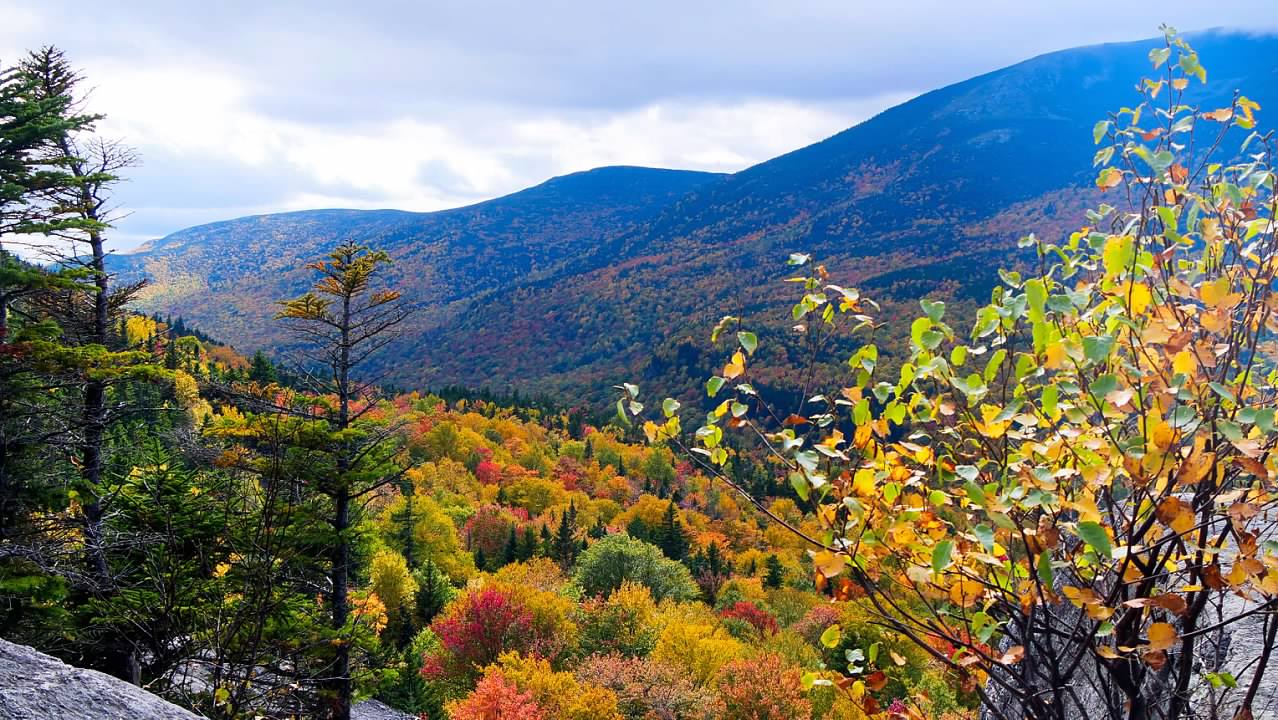
 Back at the visitor center, we found a picnic table to eat our lunch and consider our options. Our hikes thus far that day hadn't taken as long as I had expected, so we decided to do one more hike from this location, a climb up to Square Ledge to take in the view across the valley to Mt. Washington. Again, we crossed the highway and used the boardwalk across the wetlands, but this time we turned up hill away from the highway and began to climb up to the ledge. When we reached the bottom of the cliff, there was a sizeable group of rock climbers preparing to ascend the cliff up to the ledge, but we continued past them and followed the trail around the side of the cliff and up through the boulders and rocks along the side of the outcropping, before circling back onto the top of the ledge from the rear. The views were stunning, and we could see that the colors of the foliage had brightened considerably from even the previous day. Mt. Washington dominated the view in front of us, even with the small clouds that lingered near the top. As we began to our descent, retracing our steps, the rock climbers were beginning their climbs up the cliff face.
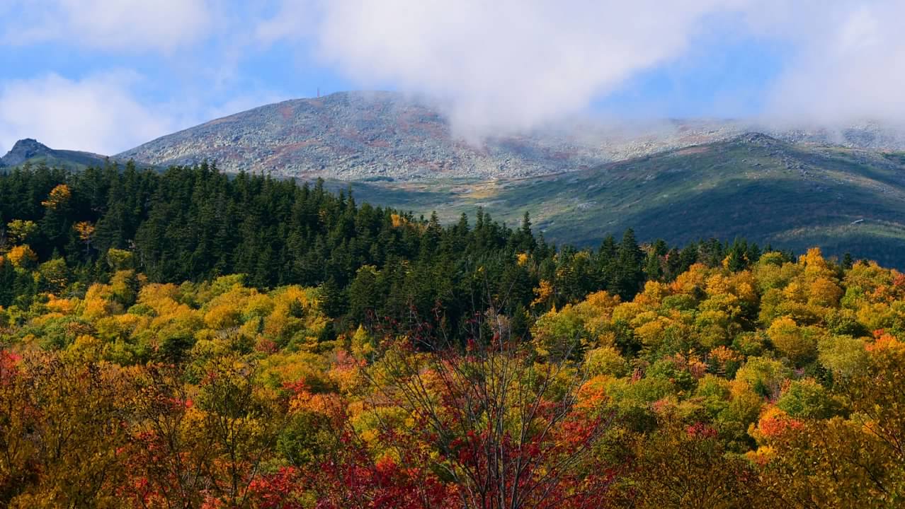
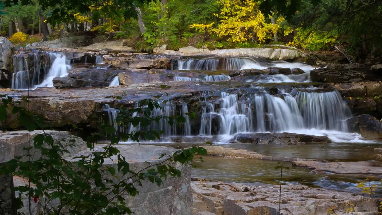
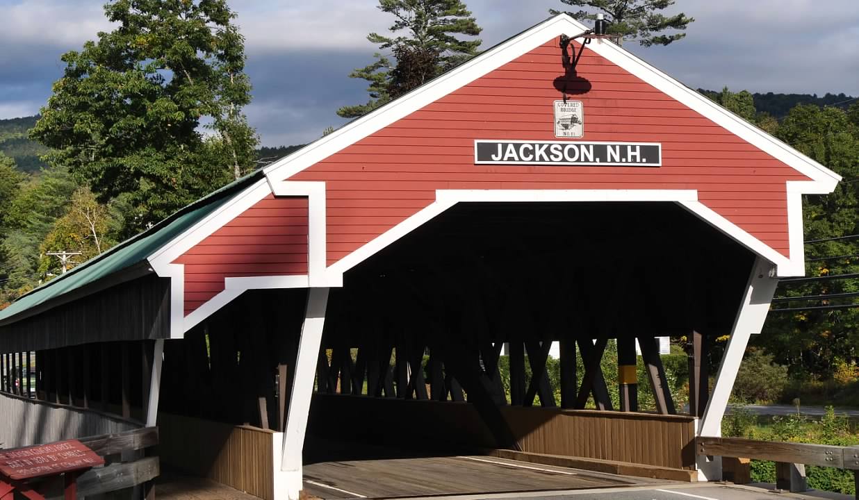
 From the visitor center, we drove back down the valley to the town of Jackson. Here we parked across the street from the historic Wentworth Inn, which served tourists visiting the Jackson Falls in the late 19th and early 20th centuries. As we walked up the river here, we took in the falls (two sets, the lower, which were a little harder to reach and see, and the upper, which were readily accessible with walkways and benches to enjoy them from) and learned more about the history here. Railroads made this area a popular tourist destination in the 19th century, and much like the Catskills, artists found much inspiration here in the White Mountains as well. After seeing the falls, we made one final stop to see the covered bridge over the Ellis River at the south end of Main Street before returning to our accommodations for the night.
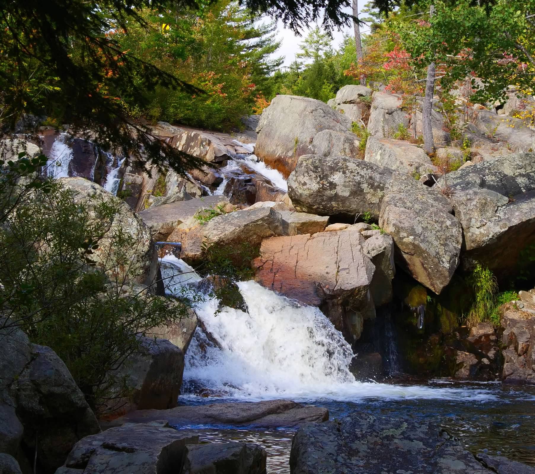
With that decision made, we opted for a series of shorter hikes in the Pinkham Notch on the east side of Mount Washington. This pass is the location of the Pinkham Notch Visitor Center, operated by the Appalachian Mountain Club, and located on the Appalachian Trail. I picked two shorter hikes to waterfalls. The trailhead parking lot for the third waterfall I hoped to visit was closed, so we decided to see if we could hike there from the Visitor Center, using a section of the Appalachian Trail to get there. However, we would have to cross the Ellis River near the trailhead to the falls, and it wasn't clear from my research what that crossing would entail, so we were prepared to turn around at that point, if necessary. We would finish our day with a visit to Jackson, New Hampshire, which had a covered bridge and a set of waterfalls in town.
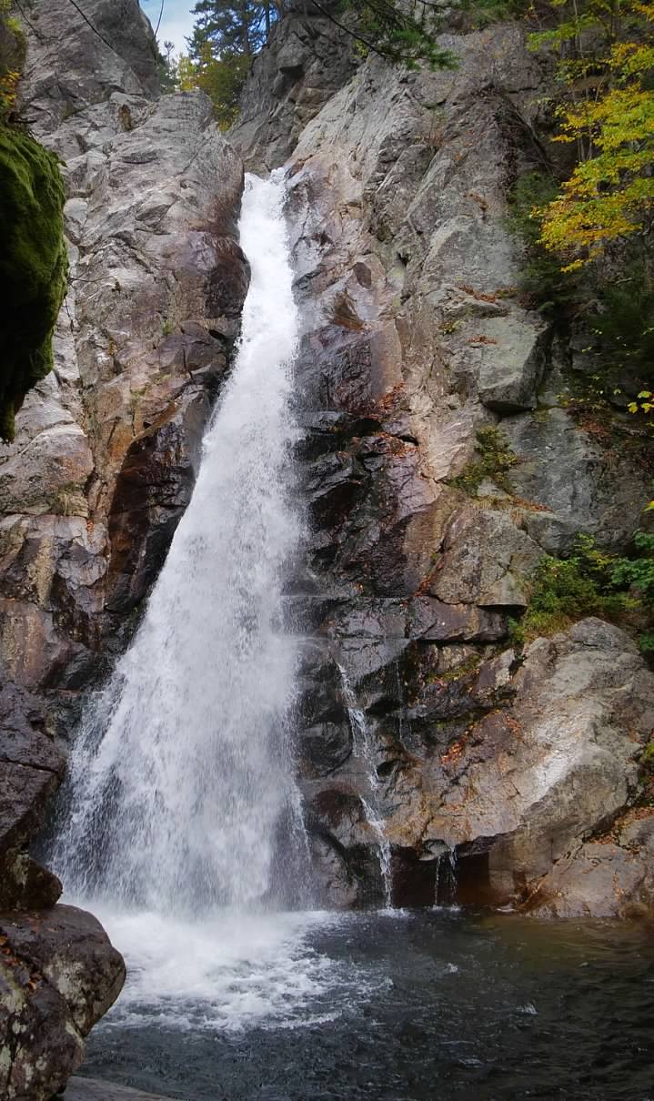
After returning to the visitor center, we crossed the highway and started our hike to the Glen Ellis Falls. Our route began with a boardwalk through some wet lands behind what appeared to be very old beaver dams. We didn't see any evidence of any recent beaver activity, so it looks like these dams were long ago abandoned by the beaver. The trail (which served as a portion of the Appalachian Trail), turned south and ran parallel to the highway and worked its way around a quiet pond. As we worked our way around the pond, we came across a few sections of the trail that crossed some fields of giant boulders, requiring a little bit of rock scrambling to traverse. Eventually, we reached a trail junction where we could turn back towards the highway and the Glen Ellis Falls trailhead. But first, we had to traverse the Ellis River. At the Crystal Cascade, the river was still a relatively small stream, but by this point, it had grown significantly. But there were boulders scattered across the river, and it looked like they were close enough together for us to be able to cross the river by stepping from rock to rock. Luckily, the rocks were (mostly) dry and not very slippery, and we both were able to work our way across the river without getting wet.
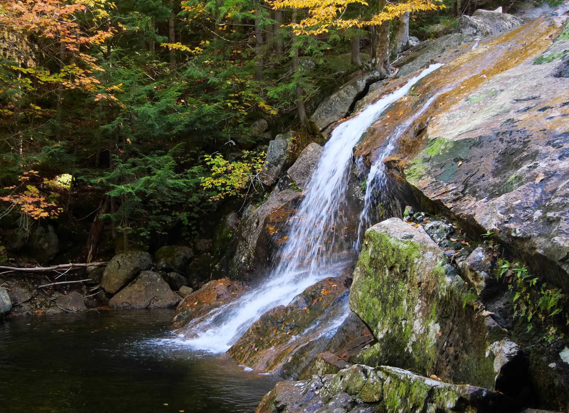
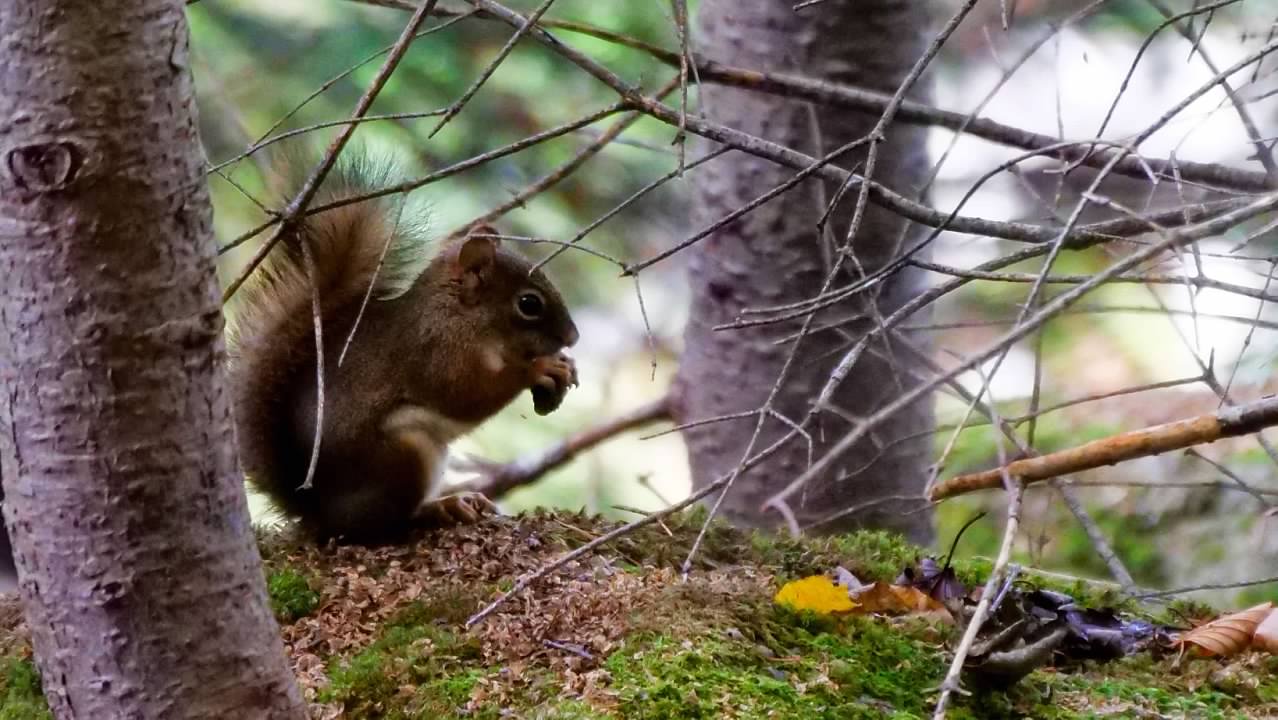
We reached the Glenn Ellis Falls trail by scrambling along the highway shoulder, and then made our way down the short trail to the falls, which were one of the more impressive we'd seen to this point. We then turned around and began retracing our steps back the way we had come. After crossing the river, we met another couple who had opted not to attempt the river crossing and were turning around from that point, and we walked with them part of the way back to the visitor center. Along the way, we saw lots of squirrels that were smaller and browner than the grey squirrels we were used to at home. These were American red squirrels, and they largely ignored us, which allowed us to move around them and take photos without them running for cover.