expedition_retirement: (United States)
 The last time we passed through Topeka, Kansas, we paid a visit to the Equality House, owned by the non-profit organization Planting Peace. Located across the street from the Westboro Baptist Church, the Equality House is positive reminder that hate is not the final answer, and that good people can and should confront bigotry and hatred. We had also wanted to stop at the Brown v. Board of Education National Historical Park on that trip, but we weren't there during the hours they were open, and so we had to skip it.
Brown v. Board of Education National Historical Park
This time we made a point of visiting Brown v. Board of Education National Historical Park. Housed in the former Monroe Street School, which was one of the segregated Topeka public schools that formed the basis for the court case in Brown v. Board of Education, this site tells the story of that landmark Supreme Court decision and highlights its role in the broader fight for civil rights. This "park" is really more of a museum, with two primary exhibit galleries. The first tells the story of school segregation, from the doctrine of "separate but equal" that arose out of the 1896 Supreme Court decision in Plessy v. Ferguson, to the various court cases supported by the NAACP to challenge this principle. Five of those cases, from four states (Kansas, South Carolina, Virginia, and Delaware) and the District of Columbia, were combined into a single case for appeal to the Supreme Court. NAACP lawyer Thurgood Marshall (later appointed as a justice on the Supreme Court) used psychological research to argue that separate was inherently unequal and that segregation, in and of itself, placed minorities at a disadvantage. This argument was so persuasive that the Supreme Court ruling in Brown v. Board of Education was a unanimous 9-0 holding that separate but equal was unconstitutional.
Monroe Street School
The other gallery showed the legacy of the decision, placing it in the broader context of the Civil Rights movement of the 1950s and 1960s. Even after the Supreme Court issued its decision, the fight to desegregate schools was far from over. Over and over again, local authorities fought back and resisted efforts to end segregation. In some cases, entire public school systems closed rather than desegregate. In other cases, the federal government had to step in to enforce desegregation. Progress was (and continues to be) slow and incremental. This museum is a reminder of how long and difficult the struggle has been, and stands as a beacon for what could be, even as hard fought gains are slowly eroded away.
Civil rights mural
From the street, the building looks like what it used to be, a modest neighborhood elementary school. Except for the NPS sign on the lawn, it would be easy to pass by without any idea of the role this building played in our history. The side of a nearby building has been painted as a giant mural celebrating the Civil Rights movement. Somehow, standing here in this moment seemed important, to witness this piece of American history, and to understand its importance in light of current events.
expedition_retirement: (United States)
The Great Sand Dunes National Park and Preserve was the final stop that was firmly in our itinerary for the trip. From there, the plan was to allow our pace to be dictated by how we felt. If we were ready to just go home, then we would head east with that goal in mind, working to get home as soon as possible. However, I had tentatively identified a couple of other potential stops along the way in case we were feeling up to doing more.
Amache National Historic Site
The first of these was Amache National Historic Site, in eastern Colorado. This is the newest NPS site we've ever visited. Established as a National Historic Site on February 15, 2024, this site encompasses one of the ten "War Relocation Centers", camps where resident and citizens of Japanese descent were interred during the Second World War. We previously visited another of these camps at the Manzanar National Historic Site in California, and found that to be both educational and moving. Because this site was so newly established as a NPS site, I didn't expect there to be much to see on the actual site, as there hasn't been much time for the Park Service to do a lot of restoration work. However, the Amache Preservation Society, founded by a local high school history teacher and largely staffed by student volunteers from the high school, has been working to preserve the site for many years, and has created an online audio tour of the site. All of which meant we spent far more time here than I had anticipated. In addition to listening to the stories taken from oral histories shared by former internees, we also saw the reconstructed water tower, guard tower, and barracks buildings, as well as the camp cemetery, which has been beautifully cared for by the Preservation Society and other groups. Located in the cemetery is a Memorial to the internees from Amache who died in the camp, as well as those who joined the US Army from the camp and died fighting for a country that felt the need to confine them in this remote camp. The Memorial is a dignified stone monument, standing next to a lovely cherry tree that was fully in bloom when we visited.
Reconstructed water towerReconstructed guard towerReconstructed barracks building
Amache Monument in the camp cemetery
After we finished the tour at the camp, we drove into the nearby town of Granada to visit the Amache Museum, maintained by the Amache Preservation Society, which houses an impressive collection of memorabilia from and about the camp. I found myself in awe of the work put in my the students who volunteered for the Preservation Society and were, in large part, responsible for this collection. Visiting sites like this one and Manzanar National Historic Site are important reminders of the horrific cruelty that can be inflicted upon innocent people when we give into fear and prejudice and fail to ensure that everyone's civil liberties are protected. But as disturbing as that history can be, and as worried as I might be about the current events in our nation, I found this site to be a source of great hope because of the incredible work done by the students here to remember and preserve this piece of our history.
expedition_retirement: (United States)
The Great Sand Dunes National Park and Preserve has been on my list of places to visit for a long time. I'm sure I considered it for the trip we made back in 2009, but its location is far enough out of the way to make getting there somewhat difficult. Located in the Rio Grande valley in southern Colorado, the star of this park is the 30 square mile field of absolutely massive sand dunes. The dunes are formed with sand blown off the valley floor and trapped as the winds push up and around the Sangre de Cristo Mountains, and are the tallest sand dunes in North America, with the tallest towering about 750 feet tall. But the National Park is more than just the sand dunes. The enabling legislation that created the park includes provisions that extend the park protections underground to include the hydrologic features here, which are essential to how the sand dunes survive. The dune field is bordered by two creeks that fill with snow melt every spring, and which carry sand from the periphery of the field out on to the valley floor, where the water either soaks into the ground or evaporates, leaving the sand to be blown back to the dune field to refresh and maintain the dunes. This cycle is also instrumental in the life cycles of the flora and fauna here as well, all of which is showcased in the impressive visitor's center.
Great Sand Dunes Nationa Park and Preserve
We have visited sand dunes elsewhere: Jockey's Ridge State Park on the Outer Banks of North Carolina and White Sands National Park in New Mexico in particular, but as impressive as those were, they simply were not even close to the scale we encountered here. After stopping at the Visitor's Center and learning a little about the park, we ventured out to the sand dunes themselves. As we had entered the park, we met some young ladies (ski instructors from Steamboat, Colorado, as it turned out!) who were on their way to try snowboarding on the dunes. Now, as we walked across the dry creek bed towards the dunes, we could just make them out on some of the lower dunes. They were off to the right of where most of the visitors were climbing in the dunes, and we chose to head in their direction. We climbed up close to where they were and watched them for a little while. The amount of friction between the snowboard and the sand was significantly higher than it would be for snow, and it clearly made it harder to slide. They struggled a little, but managed to get some clean runs in, but they finished and left long before we finished our hike.
Snowboarding on the sand dunes
We would spend a solid two hours hiking in the sand dunes, climbing from the peak of one dune to the next, trying to see further into the dune field. We never made it to the tallest dunes along the front edge of the field, but we did get to the top of a couple that had to be nearly 500 feet tall, which did allow us a glimpse further back into the dune field. We found that the sand was firmest and easiest to walk in if we stayed near ridge lines, and much less stable if we tried to walk out on the face of the dune. But even the relatively easier conditions on the ridges wasn't exactly easy, especially at this altitude (the base of the dunes is about 7,500 feet above sea level!). Additionally, sand was constantly filling our shoes, and the wind blowing sand at us from what felt like every direction. But the struggle was worth it for the views. Because we chose not to follow the majority of the people into the dunes, but set off in a different direction, we eventually found ourselves far enough away from everyone else that it almost felt like we were all alone in this totally alien landscape. And even when we did get a glimpse of others, they were little more than dots on the distant dunes.
The Dunes in front of the Sangre de Cristo MountainsAt the base of the dunesIn the DunesThe wind blowing sand off the top of a duneLooking into the dune field
But every footstep we took away from the parking lot was another we would have to retrace to return, and eventually we realized that we would need to turn around before we were to tired to make it back. We made a large loop through the dunes, eventually coming back to the low ridge we had begun our climb on and backtracking from there down to the creek bed. By the time we were retracing our original path, the wind had largely erased our footprints, a reminder of how little impact our presence here would have on the appearance of the dunes.
expedition_retirement: (Hiking)
We previously visited Natural Bridges National Monument on our family trip through this region back in 2009. On that trip we didn't spend a lot of time here, and only viewed the three natural bridges from the viewpoints, and didn't do any hiking. This was the only location from that trip that we would re-visit on this trip, and the plan was to hike down to each of the natural bridges for a closer look at them.

On our previous trip, we had learned the difference between an arch and a natural bridge. Natural Bridges are formed by running water, such as a creek or a river, while arches are formed by freezing ground water and wind erosion. The Natura Bridges National Monument includes the canyons of two streams that have formed three different natural bridges: Sipapu Bridge, Kachina Bridge, and Owachomo Bridge. In addition to the hikes to each of these bridges, we would also do the hike out to the overlook for the Horse Collar Ruin, which show that this area was once inhabited by Ancestral Puebloan peoples.

When we arrived, we discovered that the Visitor's Center was closed, which we hadn't expected. It was unclear if it was because the facility was still on their reduced, winter schedule, or if this was the result of budget constraints. Either way, the restrooms were open, and we were able to refill our water bottles before we headed around the one-way loop road to the overlook points and trail heads.
Natural Bridges National Monument
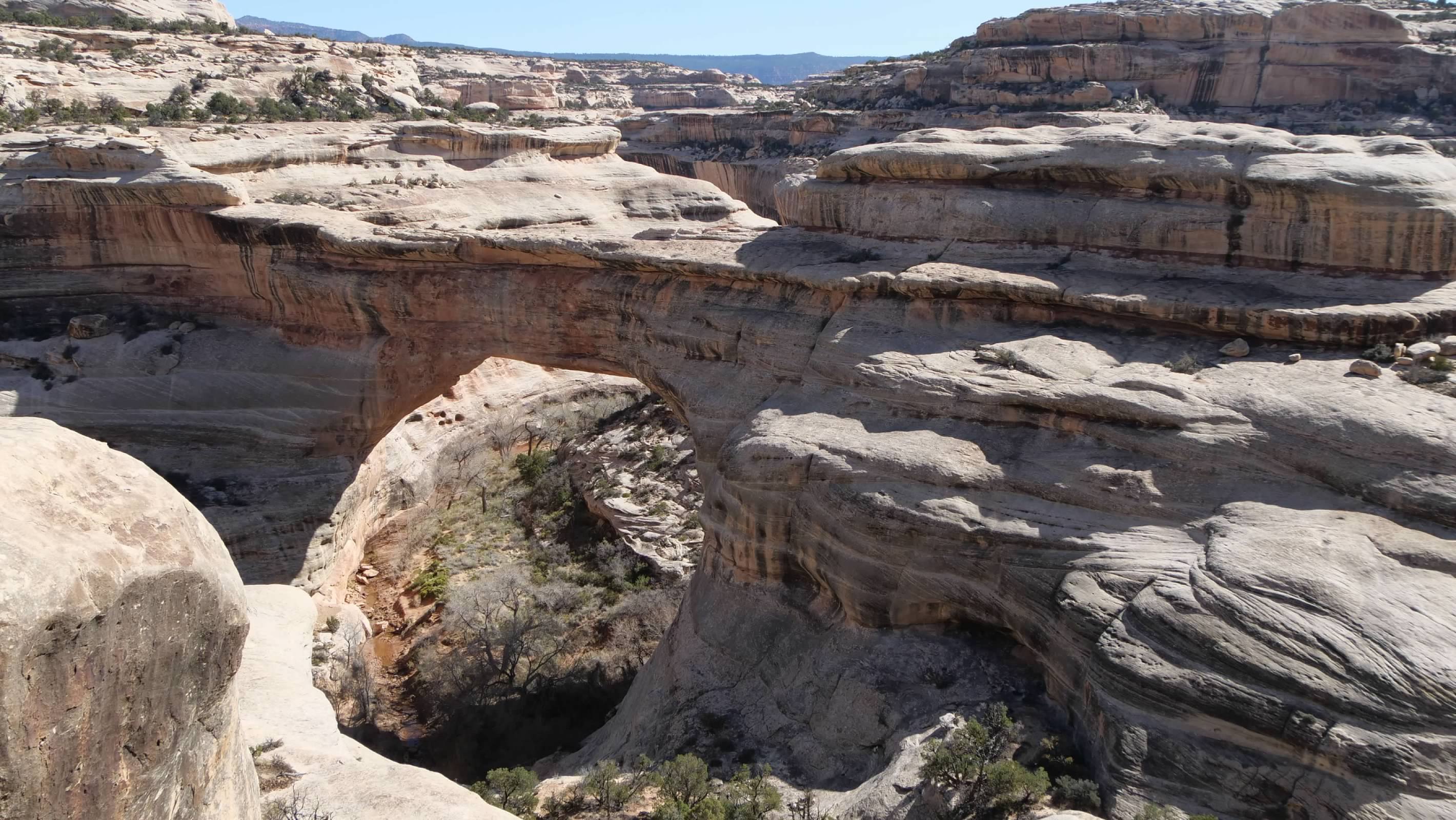
Sipapu Bridge

The first stop on the loop was Sipapu Bridge, which has separate parking areas for the overlook and the trail head. From the overlook, this bridge is difficult to make out, with the coloring of the rocks forming a natural camouflage that makes it hard to see and even harder to photograph well.
Sipapu Bridge, seen from the overlook
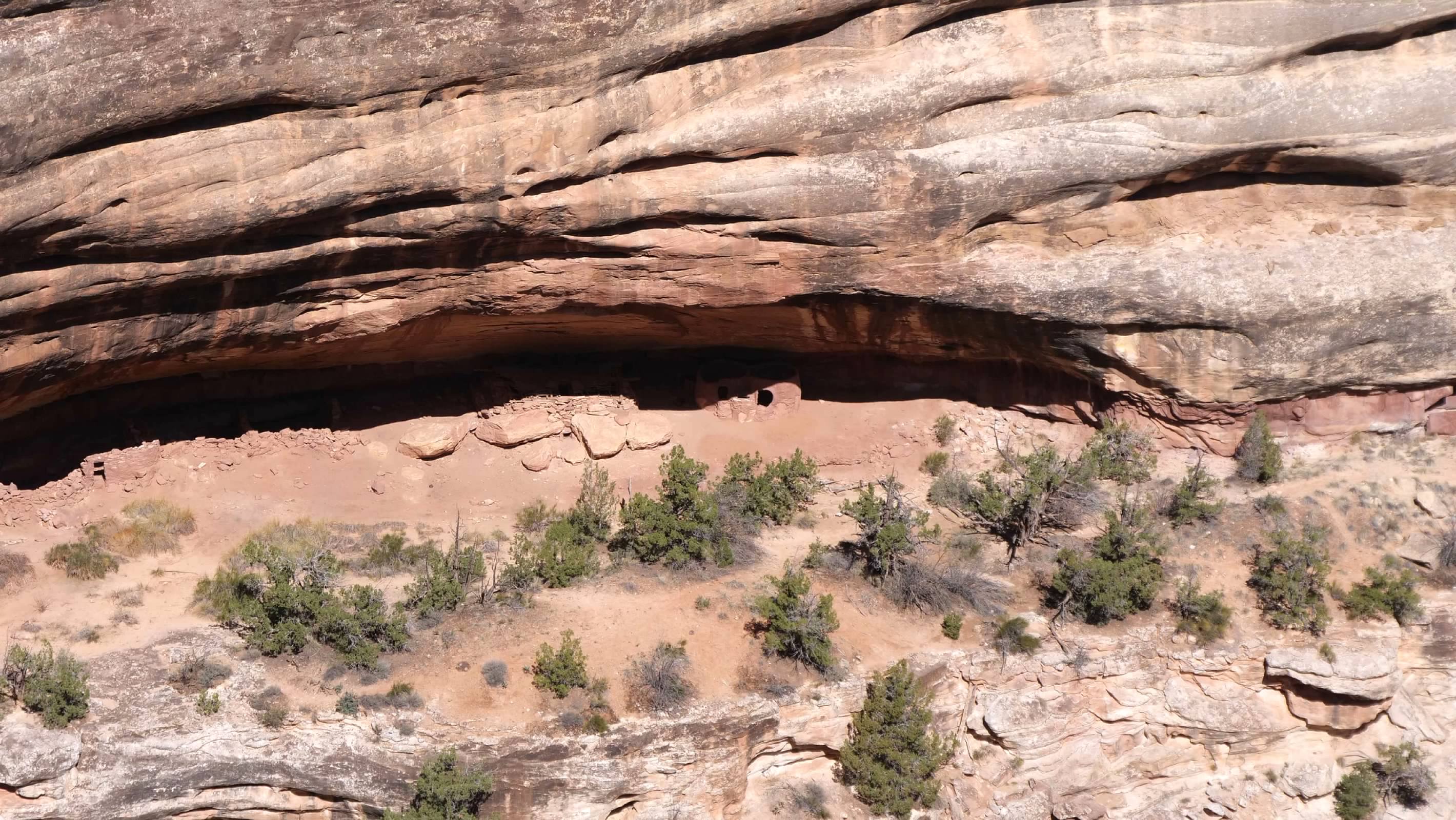
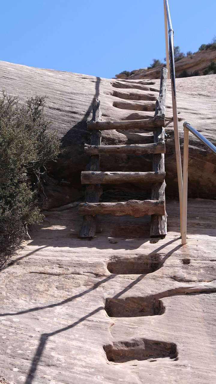
The hike down to Sipapu Bridge starts from the trail head parking lot, a bit further along the loop road after the overlook. The trail approaches the bridge from the other side, relative to the overlook, so as we hiked down, we had views of the other side of the bridge. The upper part of this trail was in the shadows of the cliff, and there was a short stretch of about 50 feet or so where the trail was covered with packed snow and was  pretty slippery. The other challenge on this hike was the ladders, which scaled some of the steeper cliffs down into the canyon. About halfway down, we found some Ancestral Puebloan ruins tucked under a rock overhang, with a stunning view of the Sipapu Bridge.
Ruins on the Sipapu Bridge trailSipapu Bridge, seen from about halfway down the trail
When we finally reached the canyon floor, we found ourselves almost directly under the bridge. Based on the position of the sun, I decided that the best place to try to get photos of the bridge was on the other side, so we walked under the bridge and along the stream bed for a bit until we got a good view back towards the bridge.
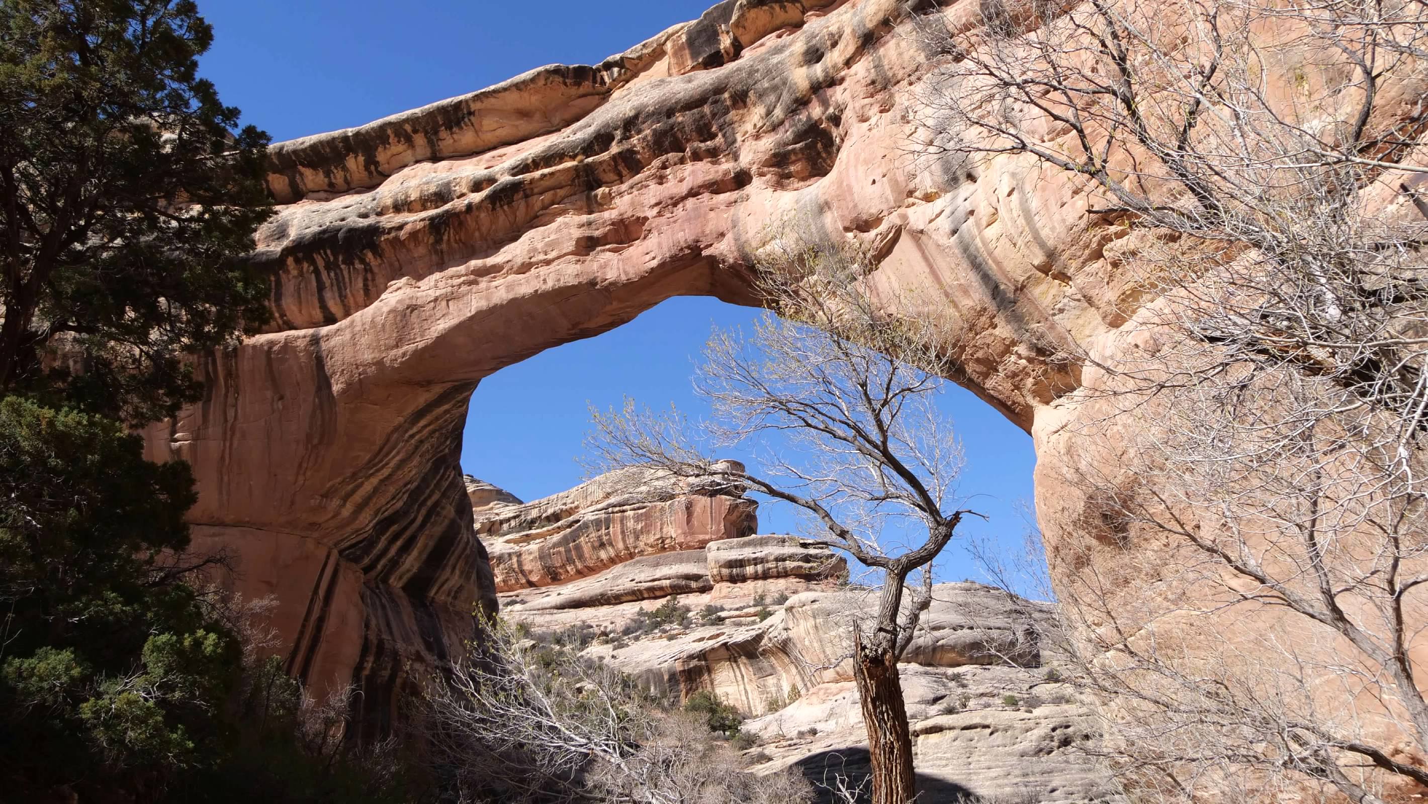
Sipapu Bridge from the canyon floor
We then began to retrace our steps back up the trail to our car. The round trip distance for this hike was about 1.4 miles, with a total vertical drop of about 436 feet from the parking area to the canyon floor.

Horse Collar Ruin

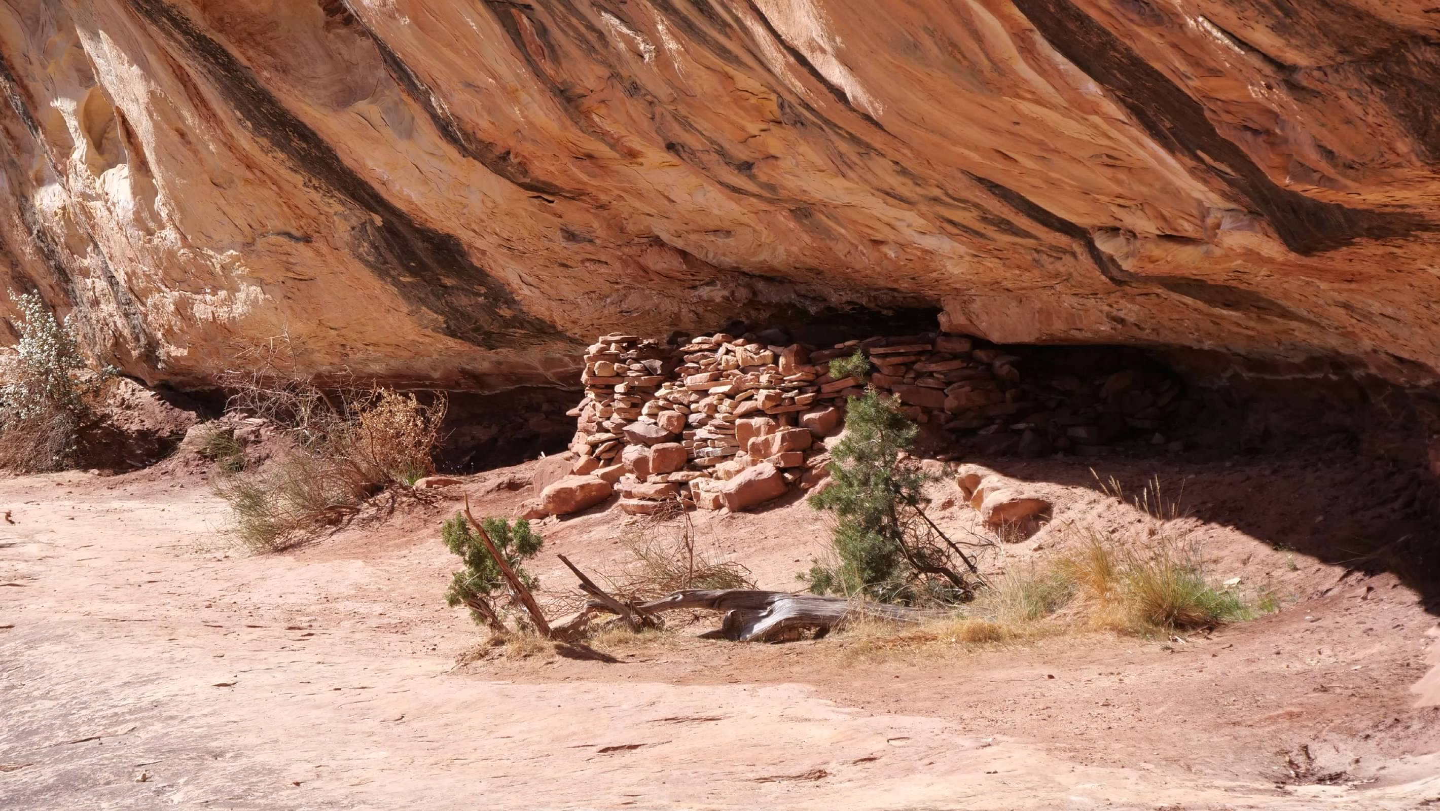
Our next hike was the relatively easy hike to the overlook for the Horse Collar Ruin. Because of the way we visited on our first visit, I don't think we gained any appreciation of this park as an Ancestral Puebloan site. None of the ruins are visible from the easily accessible overlooks, and I don't remember reading about them at the time. However, because we were hiking this time, we got to see some of the ruins, both up close, and from a distance. And while the natural bridges might be the star attractions here, the protection of these ruins is the real reason the area was originally designated as a National Monument.

The Horse Collar Ruin is located on the far side of the canyon, nestled under the overhanging rock ledge. The hike to the overlook to see them was an easy 0.6 mile round trip with very little vertical change. The overlook included signage that discussed what is known about the people who used to live here (which is apparently very little) and about the remaining mysteries surrounding their presence and disappearance.
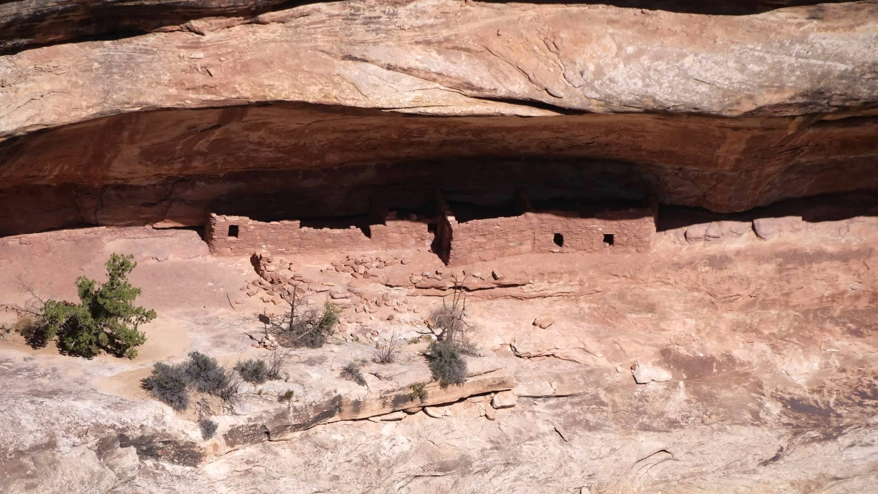
Horse Collar RuinHorse Collar Ruin
Kachina Bridge

The overlook and trail head for Kachina Bridge share a single parking area. The walkway out to the overlook is paved, and provides a view down to the bridge at the junction of the White and Armstrong Canyons. This overlook also allows visitors to see how the bridges are formed, with the White Canyon forming a sharp bend here before the junction with the Armstrong Canyon. The stone that forms the bridge was part of the canyon wall in the middle of that bend until the water eroded its way through the wall to create the bridge.
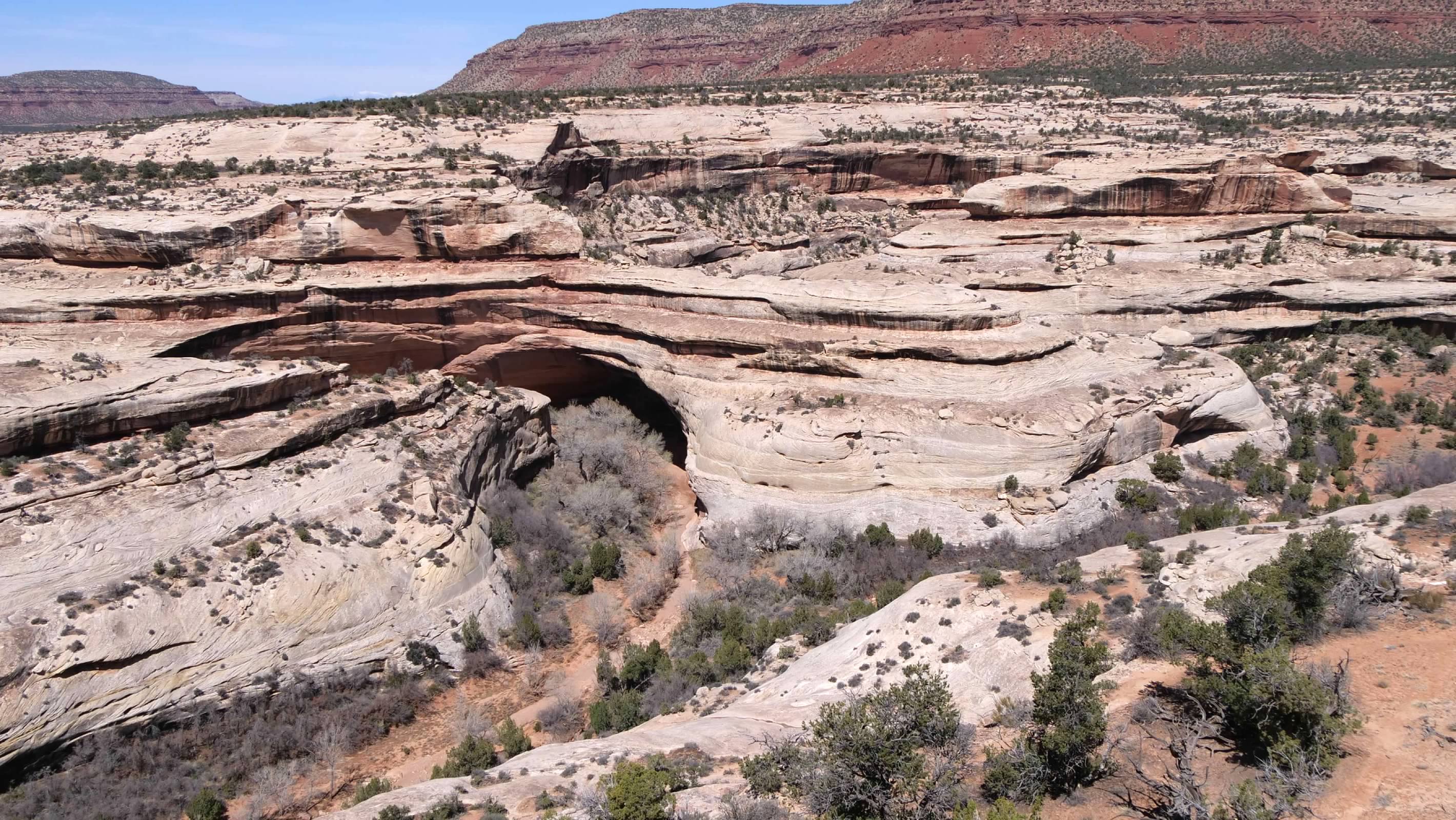
Kachina Bridge, seen from the overlook
The trail down to the bridge branches off the paved path about halfway out to the overlook, and loops below the overlook before descending into the canyon. It begins with a series of switchbacks down the steeper part of the canyon wall, before emerging on the slip rock lower down. Part way down, we discovered a small arch forming on the canyon wall, right next to the hiking trail. We also had to navigate some ladders as part of our descent to the canyon floor.
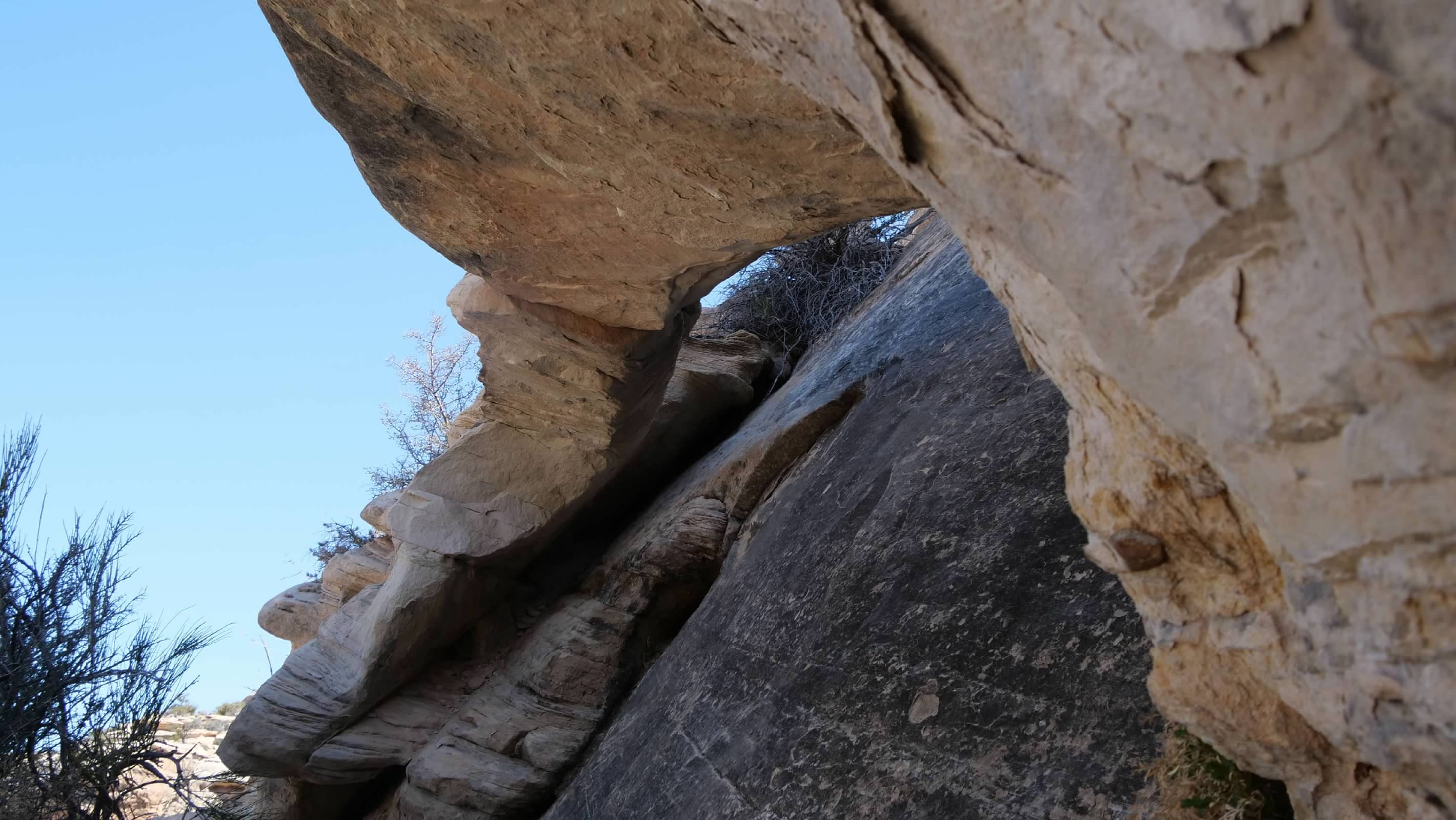
Small arch along the trail to Kachina BridgeOne of the ladders along the way
At the bottom of the canyon, we had to walk along the dry streambed in Armstrong Canyon the rest of the way to the bridge. There was a large cluster of trees and brush growing where the streams from the two canyons merge, right next to the bridge, which made it difficult to get a good photo of the entire bridge from the canyon floor. However, after some experimenting, I was able to get a decent shot from a sharp angle along the canyon wall, looking at the bridge. I was also able to get a good wide angle shot of the bridge using my phone.
Kachina BridgeWide angle shot of Kachina Bridge
After taking in the views from the bridge, it was time to make our way back up and out of the canyon. The roundtrip hike was about 1.4 miles, with a total vertical drop of 462 feet from the parking area to the canyon floor.

Owachomo Bridge

The final bridge was the easiest of the three to hike to. Again, the overlook and the trail head started from the same place, and we began by checking out the view of the bridge from the overlook.
Owachomo Bridge, viewed from the overlook
Then we began our descent down the trail to the bridge. The trail here wasn't as long, nor as steep as at the earlier bridges, making this more of a stroll than a hike. The bridge is not actually at the bottom of the canyon, since the stream has since moved, leaving the bridge standing alongside the canyon. We walked under the bridge and took some photos looking back at it. We also spotted some more ruins on the cliff across the canyon, and unsuccessfully looked for some petroglyphs we were told were in the area. Then we returned back up the trail to the car. The total roundtrip distance for this hike was just 1/2 mile, with a vertical drop of just 188 feet from the parking area to the base of the bridge.
Owachomo Bridge, viewed from about halfway down the trailThe view of Owachomo Bridge from the other side
Having finished our hikes and our visit, we made one final stop at the visitor's center to top off our water bottles before we began our drive off to our next accommodations for the night.
 
expedition_retirement: (Hiking)
 After finishing our tours the Lower and Upper Antelope Canyons, we still had most of the afternoon free to do some additional exploring in the area. Anticipating this, I had researched possible hikes in the area, and found one in the Glen Canyon National Recreation Area across the Colorado River from Page that looked to be the right length and difficulty to suit our need. To get there, we had to drive by the Glen Canyon NRA visitor center at the Glen Canyon Dam, so we stopped to learn a little bit about the dam and Lake Powell, the reservoir behind it. We didn't spend a lot of time here, but it was interesting to see that the water levels in the lake have recovered a bit from the record low it reached in 2022. However, the lake is still well below its historically normal capacity, suggesting that continued conservation efforts are in order.
The bridge at Glen Canyon DamGlen Canyon DamGlen Canyon National Recreation Area
From the visitor's center, we continued out to the trail head parking area, just a couple of miles away. Our hike was about five miles, and was neither very long, nor particularly difficult. But the desert landscape was striking, and we got to explore some interesting sandstone formations. There were plenty of others out on the trail as well, many of them trying to capture the perfect selfie photos of themselves amongst the formations. The day was warm enough to be comfortable for walking, without being too hot, and we enjoyed the couple of hours we spent exploring this small area.
After our hike, we headed back into the city of Page so we could get something to eat before we needed to head out to Horseshoe Bend for sunset. We arrived about a half hour before sunset, and tried to figure out where to best photograph this incredible vista. I found myself struggling to capture the entire scene in a single frame with my camera. My widest angle focal length simply wasn't wide enough to get the whole thing. My frustration was increased when I saw all the other people around me successfully capturing the scene with their phones. As the sunset and I was still unable to figure out where and how to get the shot I wanted, my wife finally convinced me to pull out my phone and take my photo with that. Sure enough, my phone was able to capture a wider angle that successfully capture the entire scene, the way I envisioned it in my head. So much for all my expensive camera gear! I guess I'm going to need to remember that my phone should be considered part of my photography equipment.
Horseshoe Bend at sunset
expedition_retirement: (Bicycle)
The break between the morning and afternoon rides on the second day of the tour was at the Tumacácori National Historical Park. This site preserves the ruins of the colonial Spanish mission of San José de Tumacácori. Built in the 18th century by Spanish missionaries, it served a similar role as the missions in San Antonio...conversion of the indigenous people to Catholicism and teaching them how to become productive subjects of the Spanish empire. This site sits inside the territory acquired by the US in the Gadsden purchase of 1853, and was designated a National Monument by Theodore Roosevelt.
Tumacácori National Historical Park
The church interior is a ruin, severely damaged by treasure hunters who believed there was silver hidden here, although the exterior is remarkably well preserved. The mission complex still retains a portion  of its exterior wall, as well as ruins of other buildings on the property and a cemetery, located behind the church. This site also seems to retain some importance to the local tribes, and they apparently gather here from time to time. This was another fascinating look back into the Spanish colonial history of this park of the country.
Mission San José de TumacácoriCemetery at TumacácoriStorage pots at Tumacácori
expedition_retirement: (United States)
San Antonio Missions National Historical ParkOf the five missions that are designated as the UNESCO World Heritage site in San Antonio, only the Alamo is not part of the San Antonio Missions National Historical Park (which has to be among the longest names in the NPS). The other four missions are (in the order we visited them): Mission Concepción, Mission San José, Mission San Juan, and Mission Espada. Each of these missions was founded in the early 18th century, and all were relocated to their current locations in the 1730s. And the churches at each of these missions continue to serve as active Catholic parishes.

We started at Mission Concepción, which is considered to be one of the oldest unrestored stone churches in the US. We managed to catch most of a tour provided by an NPS volunteer, who had a clear and deep connection to this site. In addition to talking about the history of the site, he pointed out how the architecture was aligned so that the beams of sunlight coming through the windows illuminated specific locations in the church on specific Catholic feast days. He also talked at length about the frescos that decorated the mission, both inside and out. He was a font of information, and had his own theories about the meanings of the frescos and the images included in them. He expressed a wish for enough funding to clean and preserve more of the frescos, which might make further research into them easier and might shed more light into what roll they might have played at the mission.
Mission ConcepciónInterior of Mission Concepción
Our next stop was Mission San José, the largest of the missions, and referred to as the "Queen of Missions". The NPS Visitor's Center is located here, and we watched the film presentation about the missions and their role and purpose. These missions were created by the Spanish Crown with the goal of teaching the indigenous populations how to become productive Spanish subjects. But the missionaries were motivated by a desire to convert the natives to Catholicism. The natives who moved into the mission compounds were expected to adopt European manners and learn skills that would allow them to live in a European-style economy. My wife's friend, who visited the missions with us, was deeply moved by the video, which helped her better understand her roots and heritage. We then walked around the grounds, which were the most complete of any of the missions we visited, providing us with a much better idea of what these missions might have looked like almost three hundred years ago.
Mission San JoséInteriof of Mission San José
When we reached our third stop, Mission San Juan, we found a far less complete compound. The full church here was never completed, and the current church was originally built to be temporary (Unfortunately, I somehow didn't manage to take any photos of the exterior of this church). Even though the mission was largely in ruins, aside from the church, we were becoming familiar with how the missions functioned and what the ruins represented. We also were able to explore a little of the preserved farm land, with the acequias (irrigation ditches) that survive from the mission era, showing the level of agricultural activity the missions developed.
Interior of Mission San Juan
By the time we reached Mission Espada, our final stop, we felt like we had learned as much as we were likely to that day. But Espada was easily the prettiest of the missions, at least to my eye. The other interesting part of our explorations at Espada was the ruins of the mission school, which continued to operate as a parochial school into the 1960s. Except for the signs describing this history, I would have been hard pressed to identify these ruins as being that recent. It surprised me to see how little was left of buildings abandoned only 50-60 years ago.
Mission EspadaInterior of Mission Espada
Along the way, we also learned that these four missions, along with the San Fernando Cathedral in San Antonio make up the El Camino de San Antonio Missions, a pilgrimage route for faithful Catholics. Those who complete the pilgrimage route can receive a certificate of completion, and those who walk the route can receive a 30km credit towards completion of the El Camino de Santiago de Compostela in Spain. Inside each church was a stamp that pilgrims can use to document their visit to that location.

We visited the missions because they were a designated UNESCO World Heritage site, without much in the way of expectations for what we would find. Our visit here was enlightening, showing how the Spanish colonial period changed the native culture and the landscapes of this part of North America. It illustrated how the modern culture of the indigenous peoples is a mixture of influences from their native traditions and the Spanish practices that were instilled by the missions. It was also a stark reminder that the history here is far older than many people realize, that the Spanish were here long before this land was part of the Texas Republic or the US.
expedition_retirement: (United States)
Hot Springs National Park is another place we have passed near in the past, but never actually took the time to stop at. I am not a spa guy, and I don't particularly like hot tubs, and have never been drawn to the idea of bathing in hot springs, so I wasn't quite sure that this would be a stop that I would particularly enjoy. But it is a National Park, so I figured there had to be something interesting to learn or see here, so we added it to the itinerary.
Hot Springs National Park
While the hot springs are the reason this town (and thus the National Park) exists, the Park is about so much more than the springs. The history of the hot springs, the town, and the bathhouses that made use of the thermal spring water here are actually quite fascinating. In the 19th and early part of the 20th century, the hot mineral waters of these springs were believed to have significant curative properties, and people visited Hot Springs to bath in this water (and drink it) in an effort  to cure a wide range of medical conditions. Today, only one of the historic bathhouses still operates as such (although some of the hotels in town include spas that provide baths using the thermal spring waters), and the remaining bath houses serve as the heart of the National Park, which preserves their unique architecture as part of its efforts to protect the springs and their legacy.
 
Buckstaff BathsQuapaw BathsOzark Baths
It was also interesting to see the public fountains that used the thermal spring water, both for decorative purposes, but also for drinking. There were several locations around town where people could fill water jugs with the hot mineral water for free. We filled our water bottles with it so we could have a taste. I didn't notice any particular flavor to the water, but it was decidedly warm straight out of the fountain (the average temperature at the springs is about 143F or 62C).

The park also includes a significant part of the surrounding mountainsides, where the rainfall soaks into the ground and eventually feeds the hot springs. These holdings protect the natural water flow in the springs while also providing a variety of opportunities to hike and enjoy the forests. We made the relatively short hike up the Hot Springs Mountain to the observation tower at the top. While we didn't go up in the tower itself, the hike was a pleasant escape from the people and traffic in town (even though it wasn't particularly crowded), and along the way, we noticed signs of fire in the forest. I can't find any accounts of wild fires here, so I'm guessing these were the results of prescribed burns intended to remove fuel in an effort to minimize the risks of big, out of control wild fires.

The only disappointment with our visit was that the visitor's center was unexpectedly closed when we arrived. When I planned the itinerary, the visitor's center was listed as being open seven day a week, but when we arrived, there was a sign on the door indicating that it is now closed on Tuesdays and Wednesdays. I can't say for certain, but it seems likely that this is the result of recent cuts to the Park Service funding. Regardless why it was closed, it meant that we would not get a chance to see the inside of one of these historic bath houses, or explore the exhibits inside it.
The former Army-Navy HospitalThe Arlington Resort Hotel and Spa
The city of Hot Springs, beyond the National Park, was also interesting, with some impressive examples of Art Deco architecture, including the former Army-Navy Hospital and the Arlington Resort Hotel and Spa. We also visited the Gangster Museum of America, located across the street from Bathhouse Row, where we learned about the deep connections between the city of Hot Springs and organized crime, as well as some of the other criminals that were active in and around the area. It was a fascinating look at the role crime and illegal activities had in the local economy and politics. I was also unaware that the concept of Spring Training for professional baseball originated here as well.

I'm sure that we could have easily spent a couple more days here and not been bored, but the road beckoned, and we had a deadline to meet in Arizona, so we had to settle for what we could see in a single day before moving along to our next destination.

 
expedition_retirement: (United States)
 When we booked our bicycle tour in southern Arizona, we chose not to book an air package, but instead decided we would make a road trip out and back. We left home a week before the bike tour began, leaving us time to do some sightseeing along the way, and planned to do the same on the way home. We are huge fans of the National Park Service, so it shouldn't surprise anyone that many of our stops along the way were sites under the NPS authority. But we also had some bucket list items that we hadn't been able to get to on earlier trips that we wanted to make an extra effort to get to on this one. And, we also managed to visit two more UNESCO World Heritage sites: the San Antonio Mission and the Taos Pueblo. (I've updated my list of visited World Heritage sites to include these).

When we finally returned home, we had been gone for 22 days, and had driven more than 5,000 miles. We had also completed a five day bike tour in the Sonoran Desert and the Saguaro National Park, riding a total of around 120 miles. We visited eight different NPS sites, visited several Navajo Tribal Park sites, visited friends and family, and more. We spent the trip living out of our bags...the longest we stayed in the same place was the final three nights of the bike tour. There were three other places we spent two nights, but everywhere else we only spent a single night before moving on.

It was a great trip, and it highlighted the diversity of this country in landscape, people, and activities. While this type of travel might not suit everyone, we can certainly recommend visits to any of the places we stopped at along the way.
expedition_retirement: (United States)
 On Friday morning, we checked out of our accommodations and hit the road, headed to Albany, NY. There we had lunch with a cousin and spent a relaxing afternoon visiting with her. Eventually, it was time to continue on our way and we drove a little further to our motel for the night in Pennsylvania.

Saturday morning, we started early, with the intention of stopping at the Monocacy National Battlefield, just outside Frederick, Maryland. I have been driving across this park for decades on I-270, but had never taken the time to stop and visit it. At the visitor's center, we listened to a Ranger presentation about the battle here on July 9, 1864. This battle was the result of a desperate plan by General Robert E. Lee to attack Washington, DC in an attempt to take some of the pressure off of the Union efforts around Richmond and Petersburg, in Virginia. General Jubal Early had taken his Corps down the Shenandoah Valley, largely undetected, and managed to get into Maryland, in an effort to attack Washington from the north. Alerted by officials from the B&O Railroad, Union forces under General Wallace made a stand at the rail junction here on the banks of the Monocacy River. Outnumbered almost 3-1, General Wallace knew he was unlikely to win the battle, but knew he needed delay the Confederate advance on Washington long enough for reinforcements to shore up the city's defenses. In this, he was successful, and Lee's plan to attack Washington was thwarted.

After eating lunch at a picnic table near the visitor's center, we set off on a self-guided driving tour of the battlefield. We visited the Worthington home, where the Confederate cavalry launched repeated assaults on what they thought, wrongly, were unseasoned militia troops. From there, we stopped at the Thomas Farm, site of some of the fiercest fighting of the battle, and finally the Gambrill Mill, the point from which the Union Forces ultimately withdrew when it became clear that the battle had been lost.
The Worthington houseThe barn at the Thomas farmThe mill pond at the Gambrill Mill
It was a sobering reminder of how close the Confederate Army had come to capturing the Union Capitol, and of the bloody cost of that war. The landscape here is now relatively peaceful (except for the constant stream of traffic on the interstate highway cutting through the middle of the park), which allows for contemplation of the horrors of war.