The Kancamagus Highway
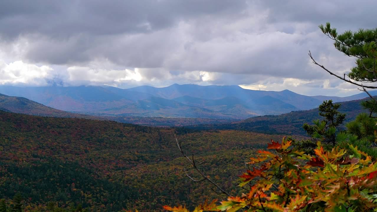
14 October 2024 04:26 pm The Kancamagus Highway runs east-west across the southern portion of the White Mountain National Forest, connecting the towns of Lincoln and Conway. The highway takes its name from a prominent local Native American chief from the 17th century, and follows the Swift River valley on the east side of the Kancamagus Pass. My research suggested that we could easily spend a day exploring various locations along the highway, so that became our plan for our fourth day here. In the morning, we drove up and over Bear Notch from the Saco River valley to the Swift River valley, and began our explorations roughly in the middle of the highway, working our way east over the course of the day.
Our first stop was Sabbaday Falls, the western-most point we reached on the highway this particular day. The trail from the parking lot to the falls was relatively smooth, without rocks or tree roots, and while it wasn't flat, it wasn't steep either. A tour bus arrived just about the same time as we did, off-loading a crowd of senior citizens on a package tour, some of whom probably found the walk to the falls challenging. But for us, it was an easy walk. The falls here were dramatic, but equally fascinating were the signs describing the geology of the site. These falls were carving a gorge in the underlying bedrock (granite), along a seam or dike of basalt that had been forced up into a crack in the granite. With the information from the signs it was easy to see the remnants of the basalt along the gorge walls.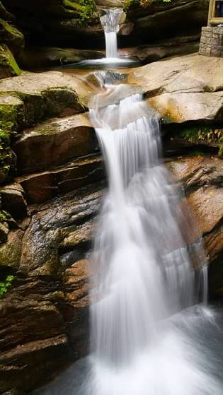
 Our next stop was the Russell-Colbath Historic Site, which preserves one of the original homesteads in this valley. The house was open, and we stepped inside to listen to the historic interpreter talk about the history of the house and its residents. We also walked through the adjacent cemetery, and walked the loop trail on the site, where we learned more of the history of the logging industry in the area.
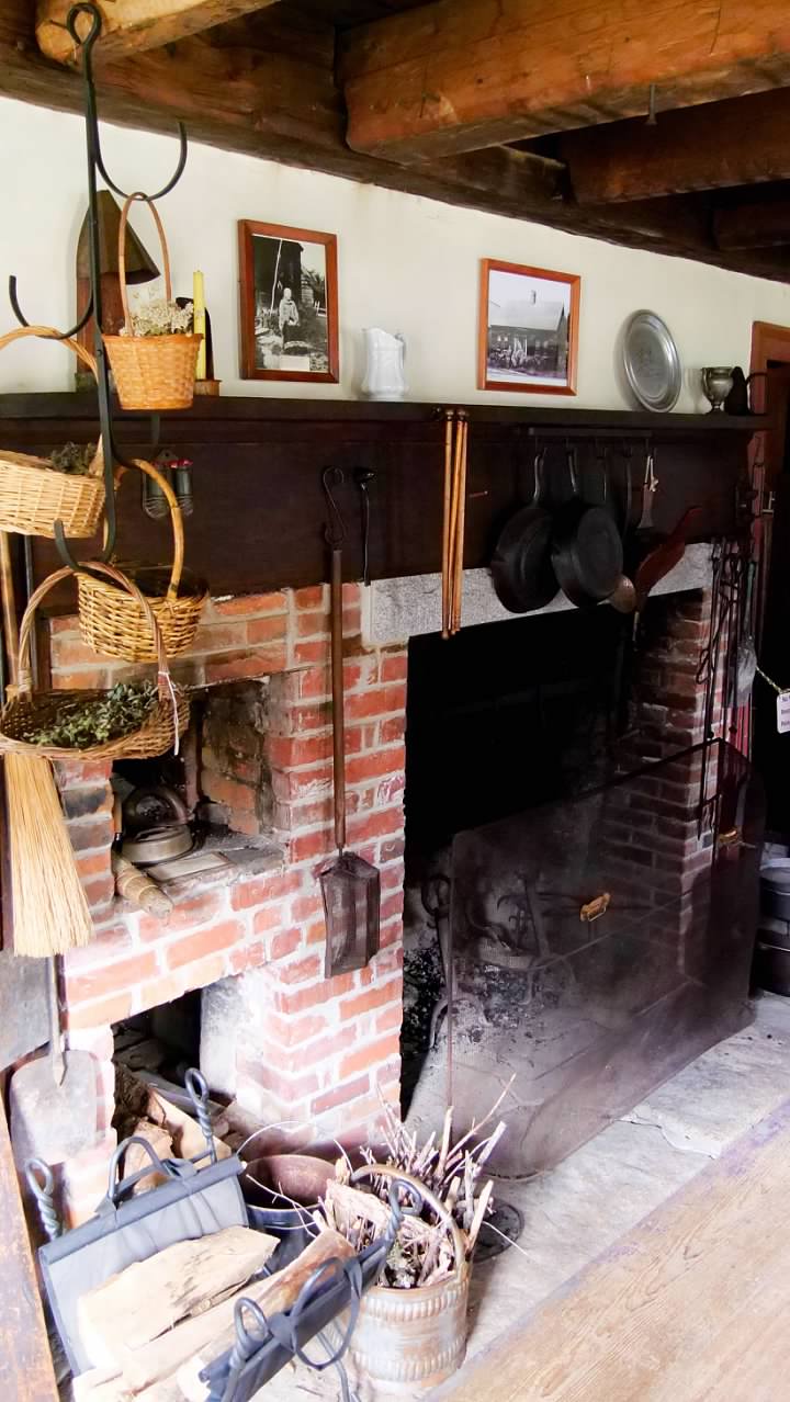

 A short drive down the highway brought us to the Rocky Gorge Scenic Area. Here, the Swift River drops down a small little gorge with small waterfall. There is a footbridge across the river just below the falls, and on the other side of the river is a loop trail around the nearby Falls Pond. We hiked around the pond, which was a short, pleasant hike, although there really wasn't any significant scenery beyond the Rocky Gorge Falls. Just a little further down the road was the Lower Falls Recreation Area, where we found a picnic table near the river to eat our lunch before checking out the set of small waterfalls here.
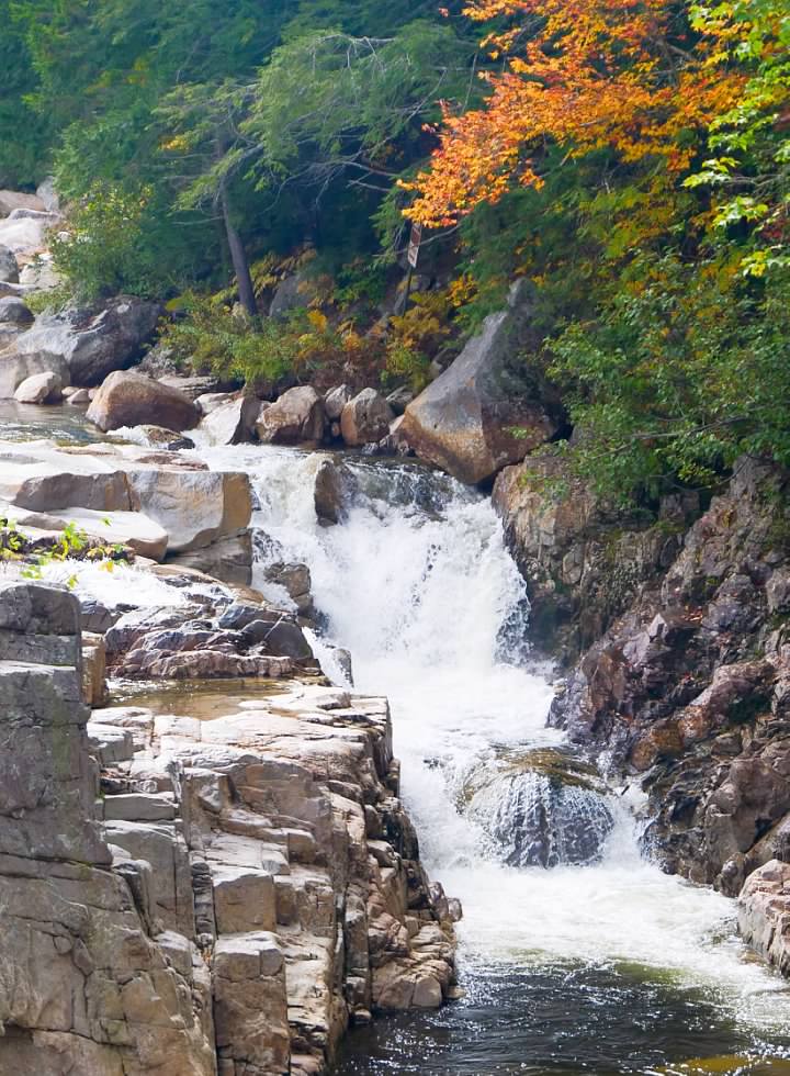
 Our last hike of the day was on the Boulder Loop trail that took us on a three and a half mile hike that included two spectacular overlooks where we could enjoy the breathtaking views. This trail was also an interpretive trail that had periodic markers that corresponded to stops on a self-guided tour. They had the pamphlet for the tour posted at the trailhead, with a note encouraging hikers to take a photo of it to use along the way. This allowed us to supplement our hike with additional information about the local geology and ecology. At the end of our hike, we took a short walk to take photos of the Albany Covered Bridge, which we had driven across to get to the trailhead parking.
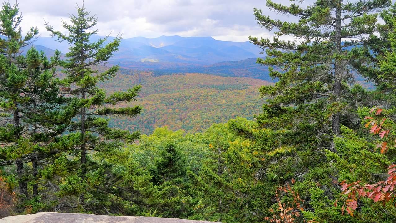
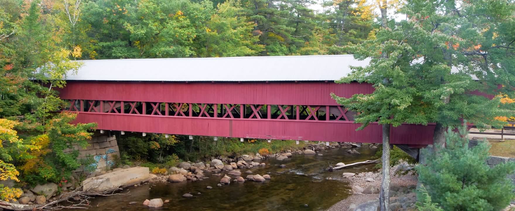
 Our final two stops for the day were the two covered bridges in Conway that we had skipped the day before. The first one crosses the Saco River, and carries the traffic of East Side Road over the river. There was a public park along the river next to the bridge, so we were able to park and walk to the riverbank for photos of the bridge. The other bridge crosses the Swift River, just above where it empties into the Saco River. The road here was diverted onto a modern bridge adjacent to the covered bridge, which is now only open to pedestrian traffic. We parked on the remnants of the old road, and walked across the bridge where I was able to get photos from the adjacent modern bridge. There was another couple that we saw at both of these bridges and we spoke with them for a few minutes before we headed back to our accommodations for the night.
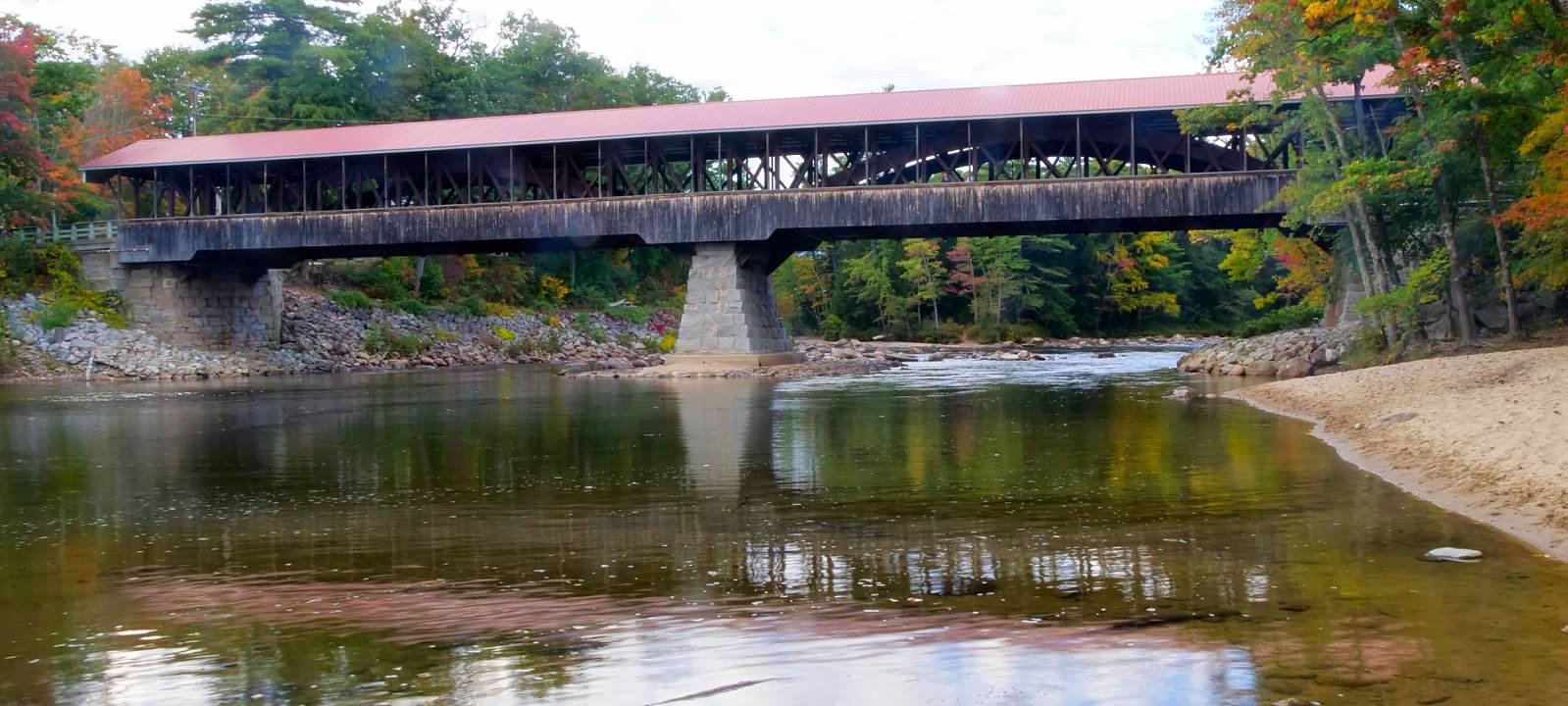
Our first stop was Sabbaday Falls, the western-most point we reached on the highway this particular day. The trail from the parking lot to the falls was relatively smooth, without rocks or tree roots, and while it wasn't flat, it wasn't steep either. A tour bus arrived just about the same time as we did, off-loading a crowd of senior citizens on a package tour, some of whom probably found the walk to the falls challenging. But for us, it was an easy walk. The falls here were dramatic, but equally fascinating were the signs describing the geology of the site. These falls were carving a gorge in the underlying bedrock (granite), along a seam or dike of basalt that had been forced up into a crack in the granite. With the information from the signs it was easy to see the remnants of the basalt along the gorge walls.