After leaving Monument Valley behind, we were headed on to our next accommodations. But along the way, I wanted to take a detour and drive the 17 mile long loop through the Valley of the Gods. It wasn't a place I was familiar with prior to planning this trip, but I saw it on the map and looked into it. The road through the valley is gravel and clay surfaced, but is passable for passenger cars as long as they haven't had recent rain. This would be one last opportunity to enjoy view of the massive sandstone formations this area is so famous for.
My plan was to enter the Valley from the west entrance, off of UT-261, and loop back to US-163 before we continued on to our accommodations. Along the way, we passed through the tiny town of Mexican Hat, UT. Sitting on the banks of the San Juan River, just outside of the Navajo Nation, this is about the only town along this route, tiny as it is (The 2020 Census shows a population of just 21). However, the geography of the area is absolutely stunning. In addition to the nearby Valley of the Gods, the sandstone ridge along the San Juan River was also very striking, especially in the afternoon sun. We ended up stopping to take some pictures of it, as well as the Mexican Hat Rock, a vaguely sombrero shaped rock formation just northeast of town (and with gives the town its name).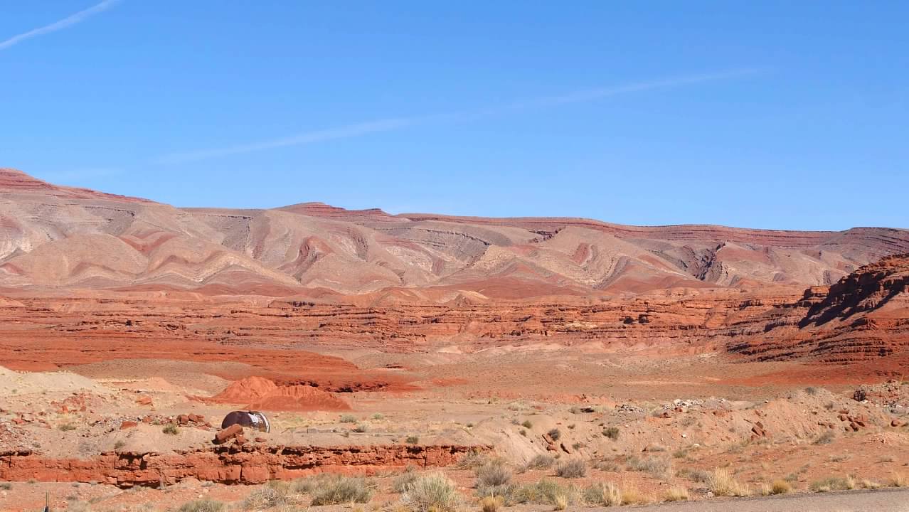
 The actual drive through the Valley of the Gods was not terribly challenging. The condition of the road dictated a slow pace, and the few times I let my speed get a little fast, we found ourselves bottoming out on the rocky segments. Perhaps the biggest driving challenge was exiting out of the washes we had to cross. The climb out of several of them was pretty steep, and there were points where all I could see was the hood of the car and sky, which was a little intimidating, especially if you don't know which way the road goes on the other side of the rise, or whether another vehicle is coming the other direction. But we made it around without any incidents, and I left with a profound respect for the drivers who managed to get their motorhomes or fifth-wheel trailer campers back on that road to the campsites where we saw them.
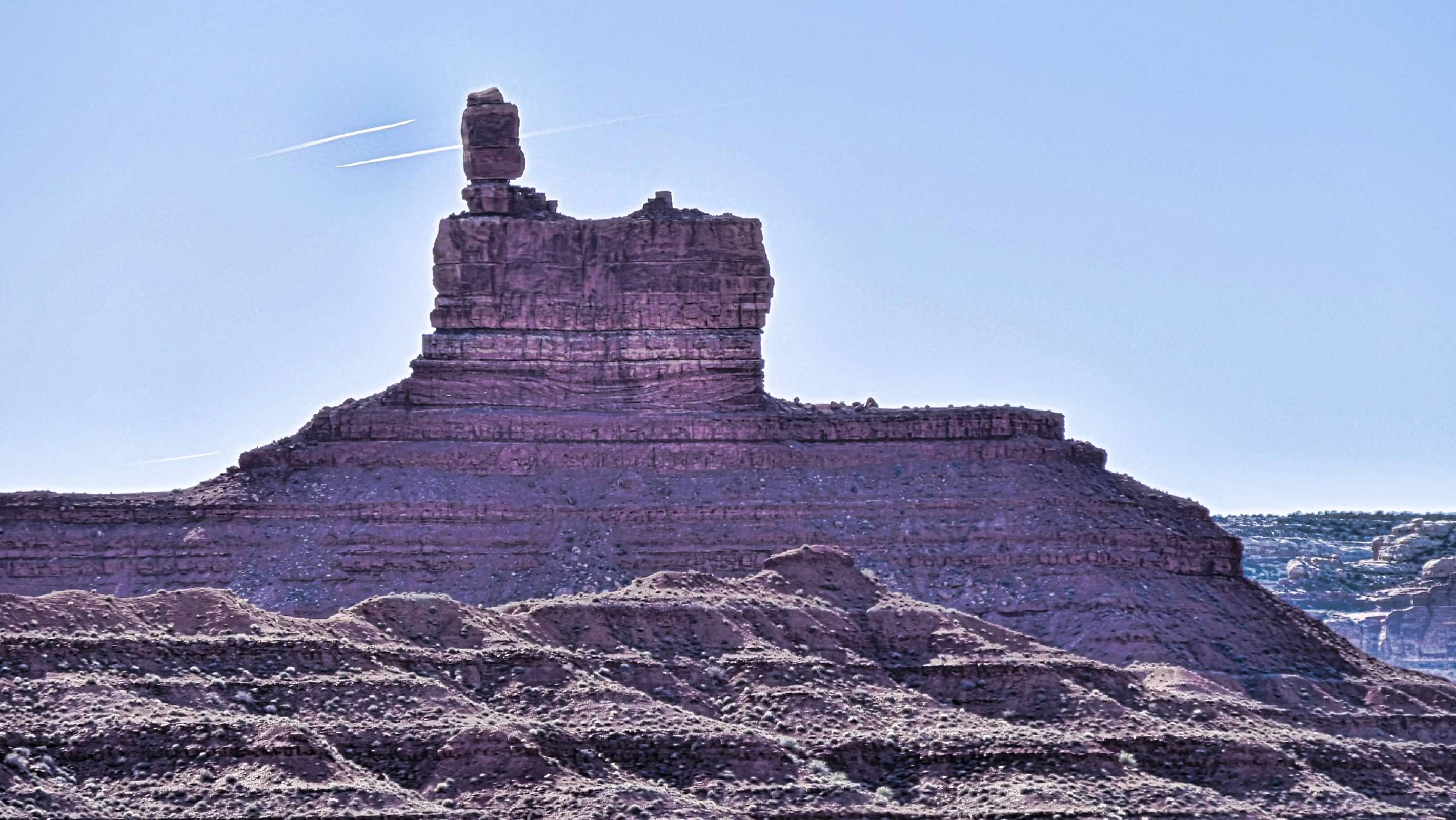
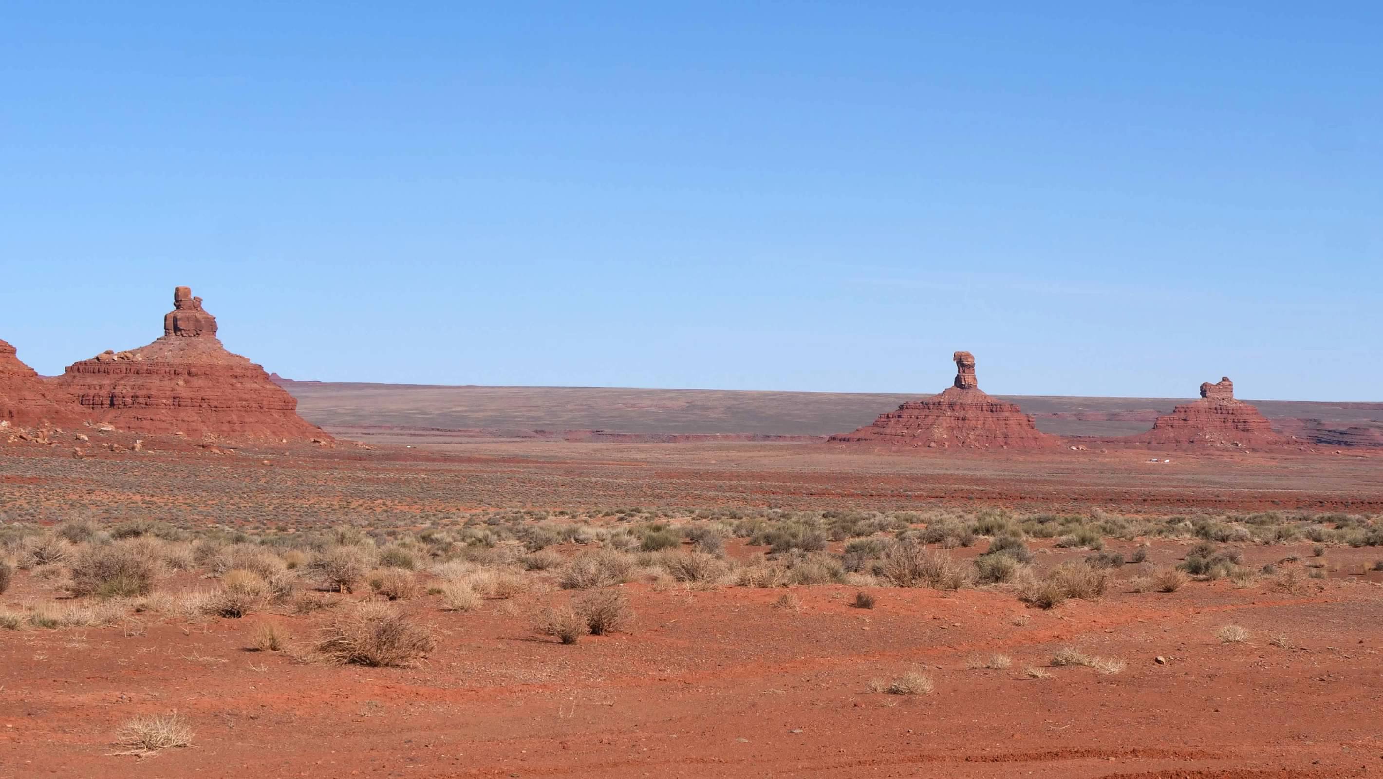
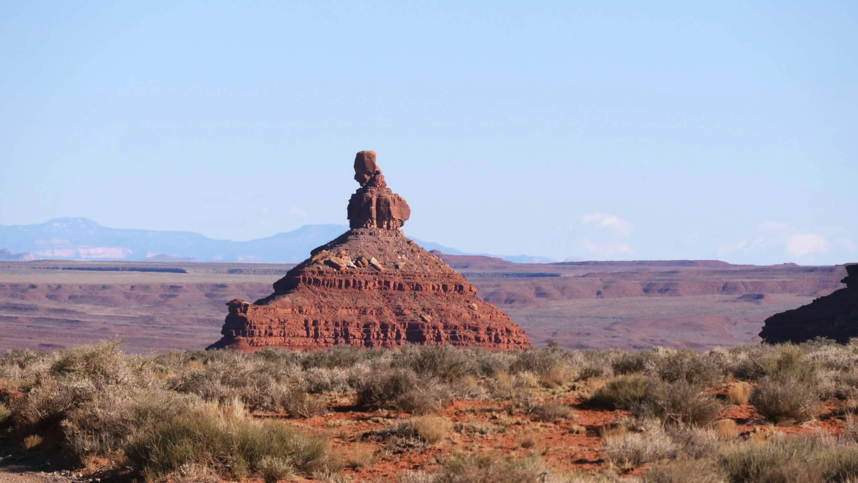
 Managed by the Bureau of Land Management as part of the Bears Ears National Monument, there is no visitor center or other services in the Valley of the Gods. Which meant we did not have any maps or pamphlet to describe the various formations. We did manage to find an online vehicle tour of the loop road, which did provide some guidance, but some of the descriptions were a little ambiguous, and we aren't entirely sure which formations had which names for part of the loop. But even without knowing the names of the various formations, they were impressive to look at, and the late afternoon sunlight brought out the red color of the sandstone, making everything that much more beautiful.
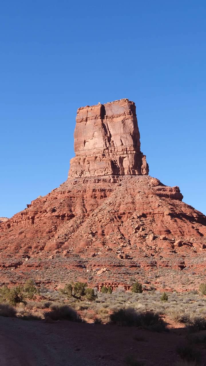
 Finally, we had finished our drive around the loop and found ourselves back on US-163, where we finished out drive to our accommodations for the night.
My plan was to enter the Valley from the west entrance, off of UT-261, and loop back to US-163 before we continued on to our accommodations. Along the way, we passed through the tiny town of Mexican Hat, UT. Sitting on the banks of the San Juan River, just outside of the Navajo Nation, this is about the only town along this route, tiny as it is (The 2020 Census shows a population of just 21). However, the geography of the area is absolutely stunning. In addition to the nearby Valley of the Gods, the sandstone ridge along the San Juan River was also very striking, especially in the afternoon sun. We ended up stopping to take some pictures of it, as well as the Mexican Hat Rock, a vaguely sombrero shaped rock formation just northeast of town (and with gives the town its name).